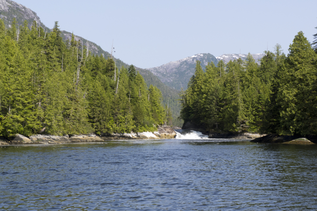
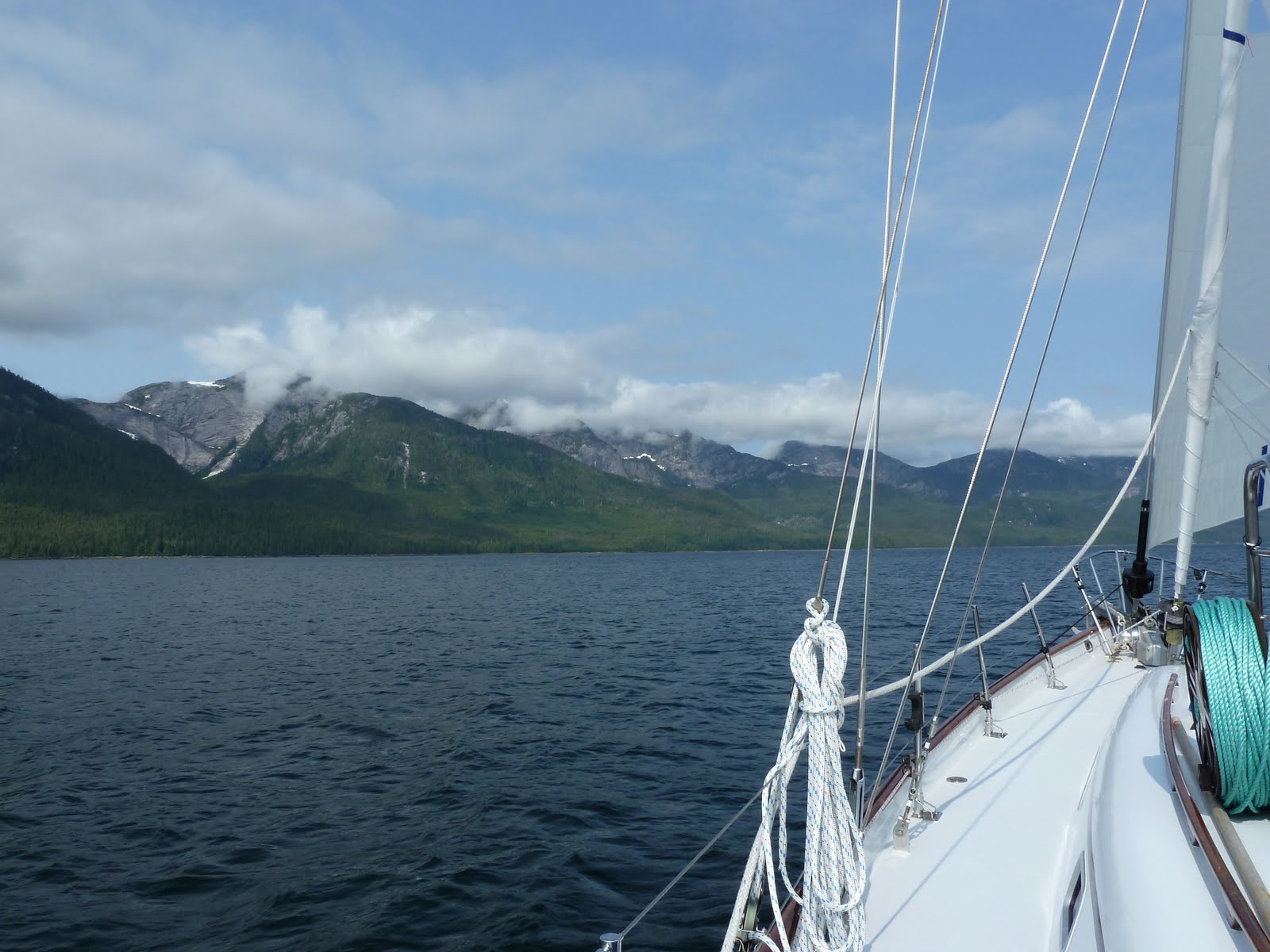
Sailing into Vancouver

Late May 2013

Quoddy's Run sails into Vancouver
Quoddy’s Run sails into Vancouver

Sailing into a large contemporary city is a wonderful and rather anachronistic thrill. It can also feel a bit daunting, for contemporary urban ports like Vancouver contain many sorts of obstacles, challenges and marine traffic, from kayaks to tankers to float planes, all moving at different speeds and in different directions. Since we’d as yet not sailed into Vancouver, we chose a day of rather calm winds and seas for our trip, looked over our charts and cruising guides, and carefully consulted the 2013 edition of that essential annual publication for Northwest boaters, Ports and Passes: Tides, Currents and Charts.

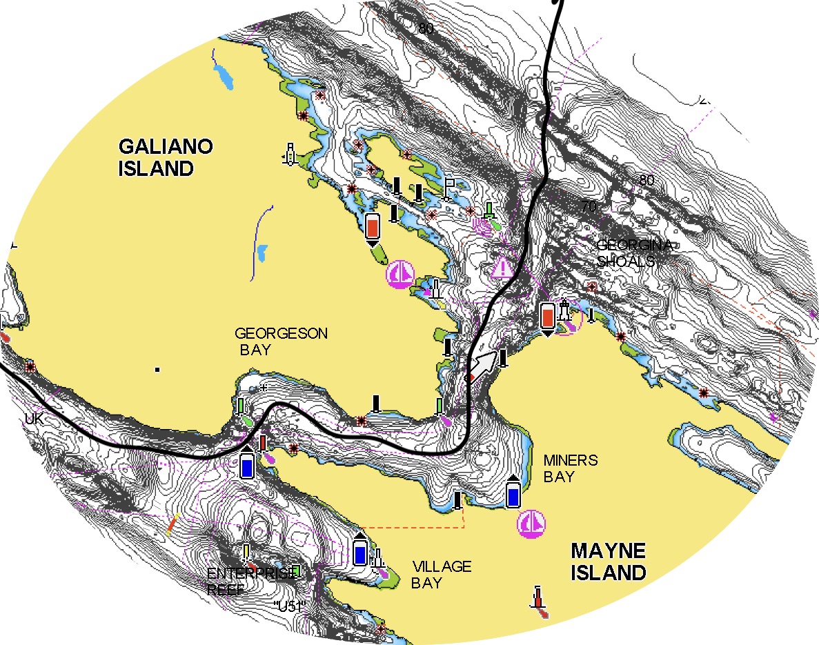
The route through Active Pass into the Salish Sea


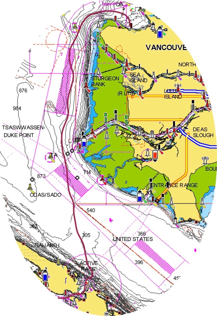
We set out early Friday morning to transit Active Pass, a narrow winding strait of swift currents and regular ferry traffic that separates Galiano and Mayne Islands, and allows passage into and out of the Strait of Georgia or the Salish Sea, as it is also known, after its first inhabitants. From there, we would angle towards the mainland, crossing the large ship traffic in the shipping lanes. We’d skirt the shallows of Roberts, Sturgeon and Spanish Banks, which lie quite (deceptively! surprisingly! beware!) far into what looks like open water, and then turn up into Burrard Inlet. Eventually we would find and dock at the Royal Vancouver Yacht Club Jericho Beach Marina. Loners rather than joiners by nature, we were astonished to learn that reciprocal privileges from our humble Sidney North Saanich Yacht Club membership would allow us to stay in Jericho Beach for several nights–a benefit easily worth the cost of our annual SNSYC membership. Our plan was to see friends, pay a visit to Costco and other retail outlets to lay in several months of bulk essentials from batteries and band-aids to pasta, olive oil, coffee, chocolate, beer, wine and tea, and to enjoy Vancouver until our elder Elisabeth arrived, when we would depart for Desolation Sound and ports north and more northerly still.

The route from Active Pass, across the (pink) shipping lanes, around the (green) banks (easy to see on the chart but from the water it just looks like you’re miles from land) and into Burrard Inlet


It was a thrill to navigate through Active Pass for the very first time on our own; even at slack tide the currents eddy through the winding pass. Orcas regularly transit the pass, along with ferries and plenty of other traffic; there’s always something to watch, and to watch out for. Once through the pass we raised sail. The seas were flat and there was just a puff of wind, around 7 knots or so, just enough to sail nicely out into the Strait of Georgia. Quite soon we noticed something peculiar: up ahead there appeared to be a line in the water. It looked like a zone of shadow, an abrupt change in the colour of the water; a ripple of current ran along its edge. But no clouds shadowed this line, nor was it a ridge of current. What was this about?

Approaching a change of colour in the water

We looked around, looked at our charts and thought a bit. We concluded (correctly) that the line of muddy green water before us marked the extent of the outflow from the Fraser River; indeed, in late May and early June, when the outflow is the strongest, river water flows nearly all the way across the Strait, sediment bearing fresh water slipping above heavier saltwater below. We passed, in moments, from burbling blue seas to flatter calmer greens which became brown as we more closely approached the mouth of the river.

Quoddy’s Run leaves the Gulf Islands, passing into waters influenced by the strong spring outflow from the Fraser River

Ferries passed back and forth between mainland and islands; a coast guard vessel appeared to be stopped in place on a fishing bank, and a few other sailboats and pleasure craft were visible in the distance. We angled northeast across the shipping lanes.

Now the peaks north and east of Vancouver hove into view from beneath thick clouds clustered at the mountain tops, where melting caps and crevasses of snow were still visible. We eased towards the mainland, now out of the influence of the Fraser River currents, the wind on our beam. We picked up speed and suddenly, there was the city.

Quoddy’s Run approaching Vancouver

The Jericho Beach marina seemed a bit tricky to find at first; there had been some renovations since our charts had been made, and because we’d never sailed in these waters before, we weren’t at all sure of the distances and landmarks that confronted us. But then after a bit there it was; we dropped sail, radioed in and arrived at dock, our friends Janice and Mary already there to catch our lines.

View of Vancouver from RVYC Jericho Beach Marina at night

A huge old club sheltered by pylons from the open harbour and named for a nearby beach, at Jericho Beach Marina we felt as though we had one foot in the wild and one foot in the city–it seemed a spectacular and easy way to visit Vancouver, albeit, not exactly “free parking.” After a few days, we realized that there was a perfectly serviceable anchorage off of Jericho Beach proper; we noted it in case we wanted to return.

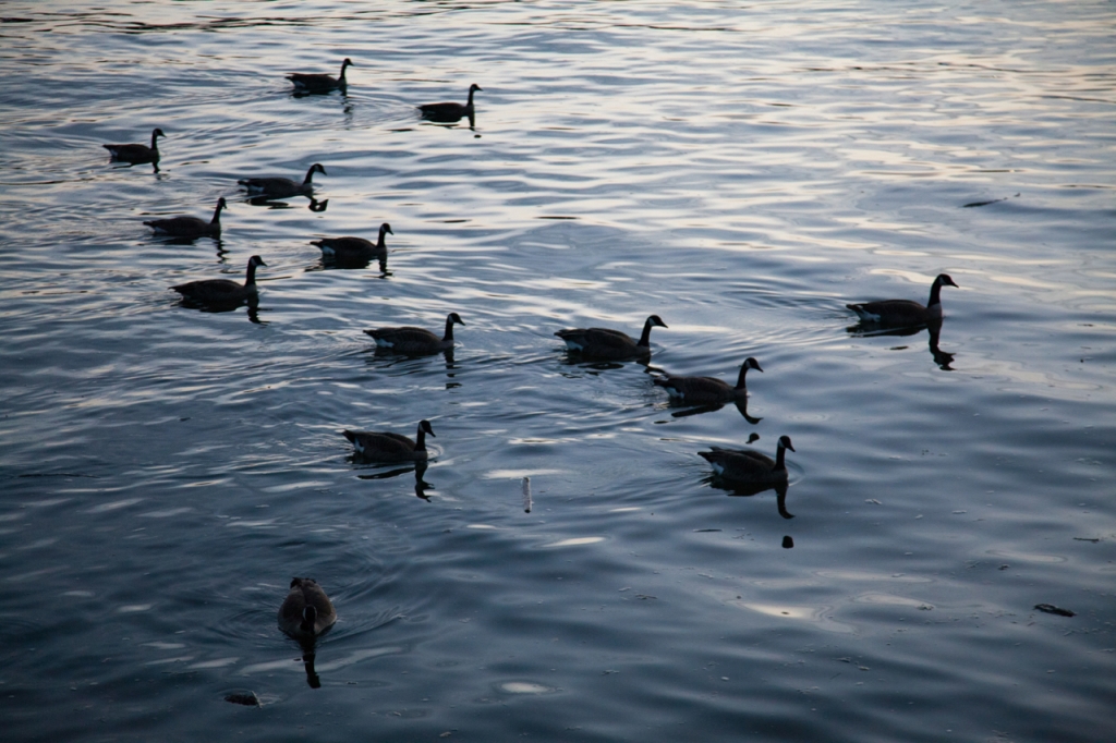
Geese leaving the land at dusk at Jericho Beach

We spent nearly a week in Vancouver waiting for Elisabeth to arrive so that we could set off, at last, for Alaska. While we waited, we decamped from the boat for a few nights to spend time with friends who live in the city. We hiked along the dykes in Steveston, ate plenty of sushi, drank too much, visited various regional gardens both public and private, and spent an absorbing day in the Museum of Anthropology at the University of British Columbia, where we were particularly struck by a mask made by contemporary Heiltsuk artist, Nusi (Ian Reid).

The mask depicts Gvna, a famous hunter and trapper and Qvumuk’ma, the King of the Sea, at the moment when Qvumuk’ma swallows an (indigestible) super tanker that has intruded on their sacred waters. Created for the occasion of a pipeline project hearing in Bella Bella, home community of the Heiltsuk Nation, the mask was designed to communicate and support the Nation’s opposition to the proposed Northern Gateway Pipeline, which would send some 200 supertankers a year carrying unprocessed bitumin through nearby coastal waters. We’d been in Bella Bella the previous year, and had also visited Wright Sound, the dangerous, beautiful and turbulent meeting place of seven waterways a day’s sail or more north of Bella, through which, had the pipeline project gone forward, those tankers would pass. Residents of Indigenous coastal communities in the area were for the most part opposed to the project, as were we, for it would mean that all those tankers, irrespective of wild weather and other significant navigational challenges, would be under pressure to go to sea. Those who knew the navigational challenges and channels were warning that, should the project go ahead as planned, a catastrophic oil spill was only a matter of time; worse still, raw bitumin sinks, and really cannot be cleaned up at all. As we’ve seen, coastal British Columbia is so beautiful and so extraordinary; there is so much life in its waters and coastal lands–why in the world should the province or its people agree to threaten all that for short term oil profits? Surely, we can be smarter than that.

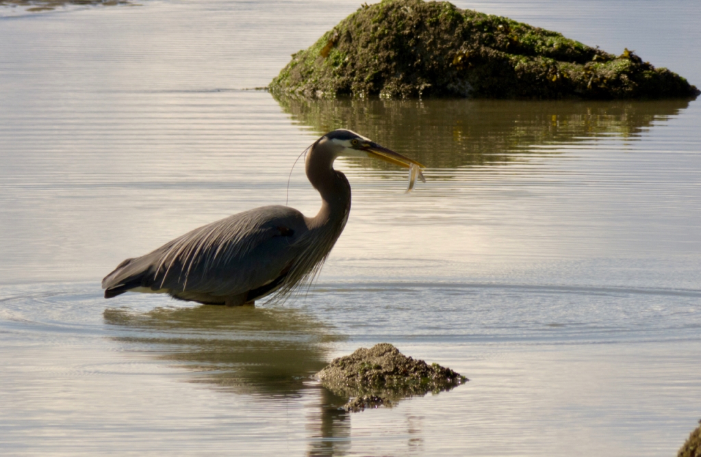
Great Blue Heron fishing off of Wreck Beach, Vancouver

After a few days on land, staying in friends’ houses, we began to miss being on the boat, for being indoors insulates you from the world. We’d been on the water for nearly a month to this point, close to birds and sea creatures, every moment dictated by the moods of the water and the weather, to which we’d had to adapt. And then suddenly we were navigating city traffic, emotional minefields, small potted gardens and the onset of depression. It felt as if we were losing the days in the dark, sitting in chairs. Indoors, the storms were all emotional; we felt buffeted by historic tornadoes, antique line squalls, a fierce wind hiding behind a chair. We felt surrounded, in tiny spaces, by swirling human relations and the weather of heartbreak. So we returned to the boat and began to provision, feeling a bit as if we’d been neglectful, as if we’d left a dog tied to a shed and failed to check on her. A day back on the boat and we felt, despite lowering clouds and spitting rain, that we’d somehow magically slipped back into our own skins.

RVYC Jericho Beach Marina


At last Elisabeth arrived. We settled her in her cabin, had a last celebratory meal with friends and prepared to cast off the next morning. But first, while we had many hands and some space thanks to a departed neighbouring vessel, we roped Quoddy’s Run  around, so that her bow was pointed towards the marina exit–one less complicated maneuver to the make in the morning. Our friends Kevin and Carmen, confirmed landlubbers, joked that they had taken part in the very first “leg” of our Alaska voyage with us. No such thing as being ready to go then: we had already departed!

Vancouver is the ancestral homeland of the Musqueam poeple.

Posted in 2013 Alaska and back | Tagged , , , , | Leave a comment

To Alaska and Back I: Getting underway

May- June 2013

_MG_7634

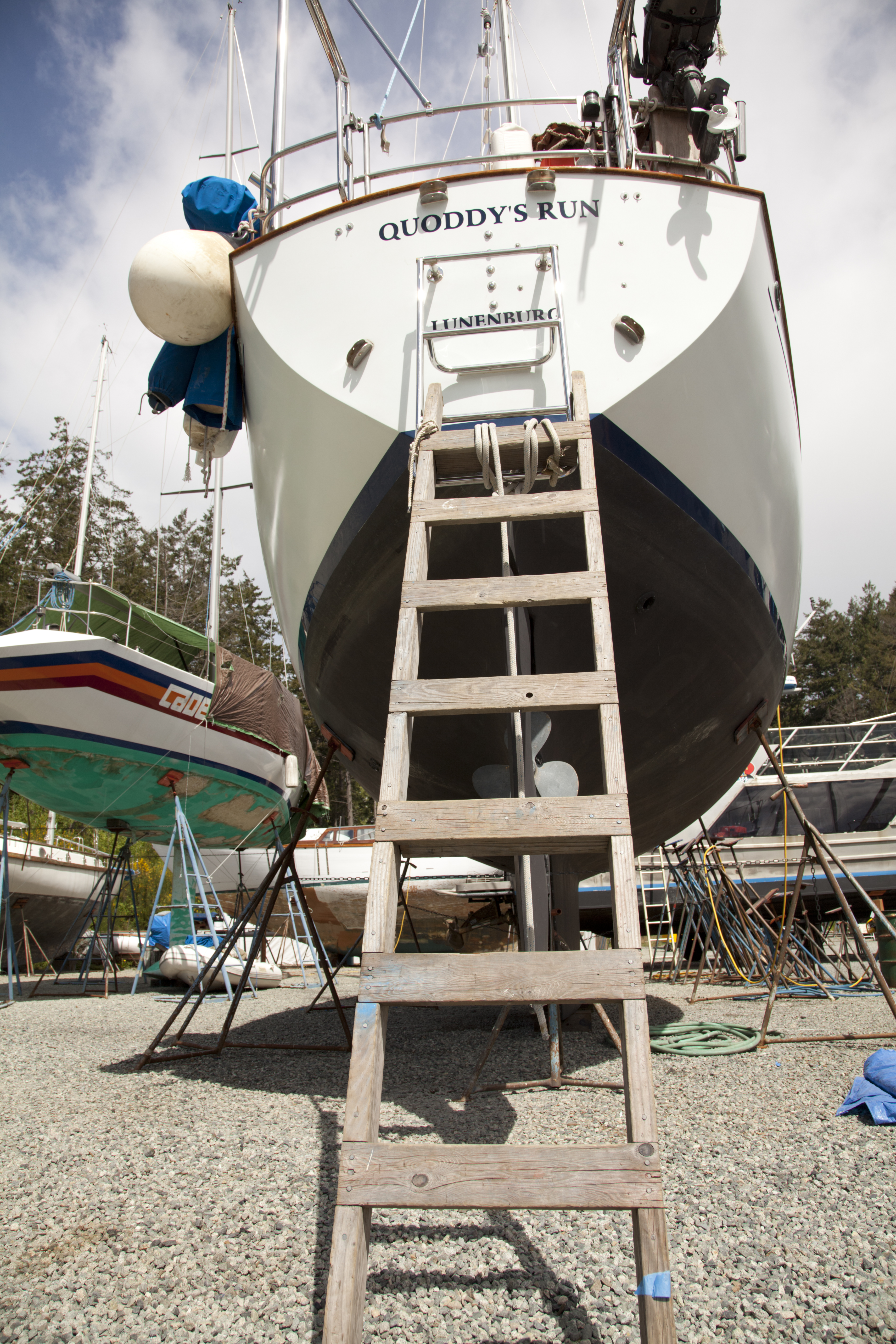
Quoddy’s Run on the hard, newly uncovered

After three seasons in BC, it had begun to feel like going home to return to Quoddy’s Run.  Even on the hard.  We arrived in Canoe Cove in late April, climbed the ladder and found the boat sweet smelling and immediately habitable. We had cleaned and tidied everything and left the boat covered, with her new ventilation hatches ajar at the end of the summer the year before, and she was in perfect shape.  For a few days we lived on the hard while we provisioned and Kelly Thody of Total Boat Marine Surveyors surveyed the boat—you have to renew your survey every few years in order to maintain your insurance. It’s a good excuse to have someone else look carefully at your boat and assess the safety and seaworthiness of your systems.

320498_278744158805364_1464378852_n

Boat houses at Canoe Cove

It was wonderful to be back in the “land of the big trees;” each evening, after our chores, we walked around the docks or wandered the neighbourhood. One night we watched a family of river otters bed down in a pile of dead leaves; another evening we tracked damp racoon prints across sweet smelling cedar boards. The boat houses of Canoe Cove fascinated us–such fancy “boat garages” would be impossible to maintain in Nova Scotia, where each winter, snow and ice would wreak havoc on them. We also liked to peer at the  starfish, fans and sea anemones that attached themselves to the pilings; we lived by and on the Atlantic, but everything here was different, brighter, bigger, multiplied.

_MG_7637

It’s a looooong way up when you’re carrying heavy bags

As usual, in addition to the necessary volumes of groceries, charts, solvents and liquor supplies to haul up the ladder, there were a few unexpected surprises—our old batteries had finally given out and so we purchased and installed new AGM batteries, as well as additional safety equipment required by the new Canadian Coastguard Regulations.  As we were walking back from the chandlery in Sidney with ring life buoys around our necks and fuel tanks under our arms, a woman stopped to ask if we were, perhaps, on a boat.  Did we need a lift? Our relief at being offered a ride back to the boat soon became tinged with alarm when our driver turned out to be a retired geologist who specialized in plate tectonics and public education. She informed us that for British Columbia it was not a question of “if a big earthquake was coming,” but “when.” Great. More things to worry about–what if the earth moved under our boat? Or a tsunami hit? We started to notice tsunami evacuation route placards posted all along access roads to the sea. The 2011 catastrophe in Japan has made everyone on this side of the Pacific newly alert: time to think about earthquake preparedness again. But our east coast affiliations betray us here: we are distinctly unready for anything like an earthquake and have no idea even how to begin to think about it.


_MG_7707

Quoddy’s Run in the sling–about to enter the water, all 38,000 pounds of her

_MG_7721

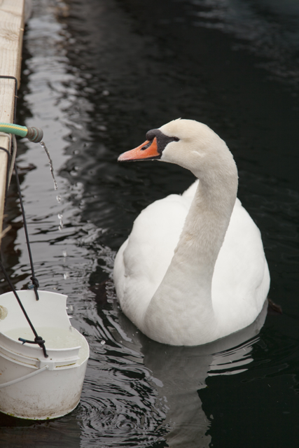
Goose begs for fresh water at Canoe Cove

Finally, we were surveyed, safety-equipped, provisioned, lubed, oiled and ready to launch. Like a water-bird, a boat is an ungainly thing on land–we dreamed, while on the hard, that we were in motion, and had to be very careful to keep balanced above decks–it’s a long and painful way down (and yes, we do know people who have fallen, and nevertheless lived to tell the tale). But once in the water, we rock in the waves, come close to other water-bourne creatures, breathe more deeply; there is the feeling that we could go anywhere in the world; after all, one waterway connects to another and another and another.


P1100486

View of the Gulf Islands and waterways from the top of Mount Bedwell, South Pender Island

May is a lovely time to be in the Gulf Islands. The land has begun to warm up but isn’t yet on fire, everything is in bloom, and the summer hordes on the water haven’t yet arrived, so finding a place to anchor, or to sit quietly, watch the local pod (known as J Pod) of southern resident killer whales cycle through and listen to the birds sing is never a problem.  It is even possible, this time of year, to hike the muddy trails in many popular parks and never encounter another person. (You do have to watch out for the commercial crab and shrimp fishers–they’re still setting trawl in May, and it’s neither smart nor kind to anchor among their pots.)

_MG_7746

Hiking around Russell Island with friends

We decided, once launched, to take a few weeks in this relatively “connected” zone to look after various pressing bits of non-sailing business–writing contracts, photo submissions, interviews and other things–and to visit with friends. At the end of the month we would sail across the Strait of Georgia to Vancouver, where we would complete our provisioning for the trip to Alaska, pick up our friend Elisabeth who would be joining us for the summer from Nova Scotia, and begin the long journey north.

317710_600739803272463_996756508_n

We sail through the round Saltspring Island race on a foggy day

Our rendezvous with friends took us took us back to many of our favourite haunts: the anchorage behind Russell Island, where we walked the trails to Maria Mahoi’s historic home; to Genoa Bay, where we visited gardens and several artist studios; to the Marine Park in Montague Harbour where it was so hot we were almost tempted to go swimming; to Maple Bay, where we picked up delicious Cowichan Valley produce; to Tsehum Harbour in Sidney, where, on the recommendation of a friend we’d met on the Central Coast the previous year, we joined the affordable Sidney North Saanich Yacht Club, and learned about the advantages of “reciprocals” or docking rights at other area yacht clubs and outposts along the south coast; and to Poet’s Cove in Bedwell Harbour, where after some particularly hard news from home (more about that in a future entry), we spent a day at the spa, steaming, swimming, resting, warming up–for it can be cold out on the water, particularly when the fog comes drifting in.  In each place our circle of friends widened; every couple of days we went for long hikes and bit by bit we got our non-boat work done, bent on the sails and generally made sure that everything was in good working order.

P1100529

Arbutus trees on South Pender Island

A last row to the beach to hike up Mount Norman, which is 3+ kilometres each way and nearly vertical.  We’re puffing by the time we arrive at the summit and see the islands spread out before us. There’s Saltspring and Piers and Mayne and Sidney Spit and Russell Island and a cargo ship tracking along the border.  Wild currents swirl between the two countries in Border Passage: you can see them from the heights. On the trail we step over a banana slug as large as banana, the largest one we’ve ever seen. Tiny orchids bloom on the forest floor and birds flutter and sing in the high branches. The salal is beginning to bloom. We remember walking this trail a year ago, when it was much wetter.

As we return to the beach a small bird of a sort we’ve never seen before approaches us. It cries out again and again, a sort of trilling buzz and moves closer to us still. So we stop to wait and see what will happen next.  Suddenly there, just to the side of the path, movement. A tiny little speckled bird hops through the dead leaves towards its buzzing parent.  Other birds of the same species pass overhead. We move quickly on. Don’t worry, we say, as if to the parent bird, we won’t step on your baby.

We row back to the boat, where after much searching of our bird guides we decide we’ve encountered a  Hutton’s Vireo parent and baby, perhaps in a flock with Ruby-crowned Kinglets.  But in truth, we aren’t sure and don’t know.

Dinner, darkness, sudden rain, sleep–and then, as if in the blink of an eye, it is time to cross over to Vancouver.


Posted in 2013 Alaska and back | Tagged , , , | Leave a comment

Back in the shadow of land life

P1100765

Nigei Island

4 August 2012 Port Alexander, Nigei Island

Screen Shot 2018-07-15 at 2.13.38 PM

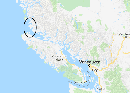
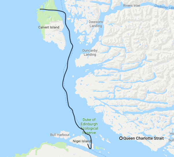
Map showing distance covered from from Calvert Island past Cape Caution to Nigei Island in relation to Vancouver and Vancouver Island

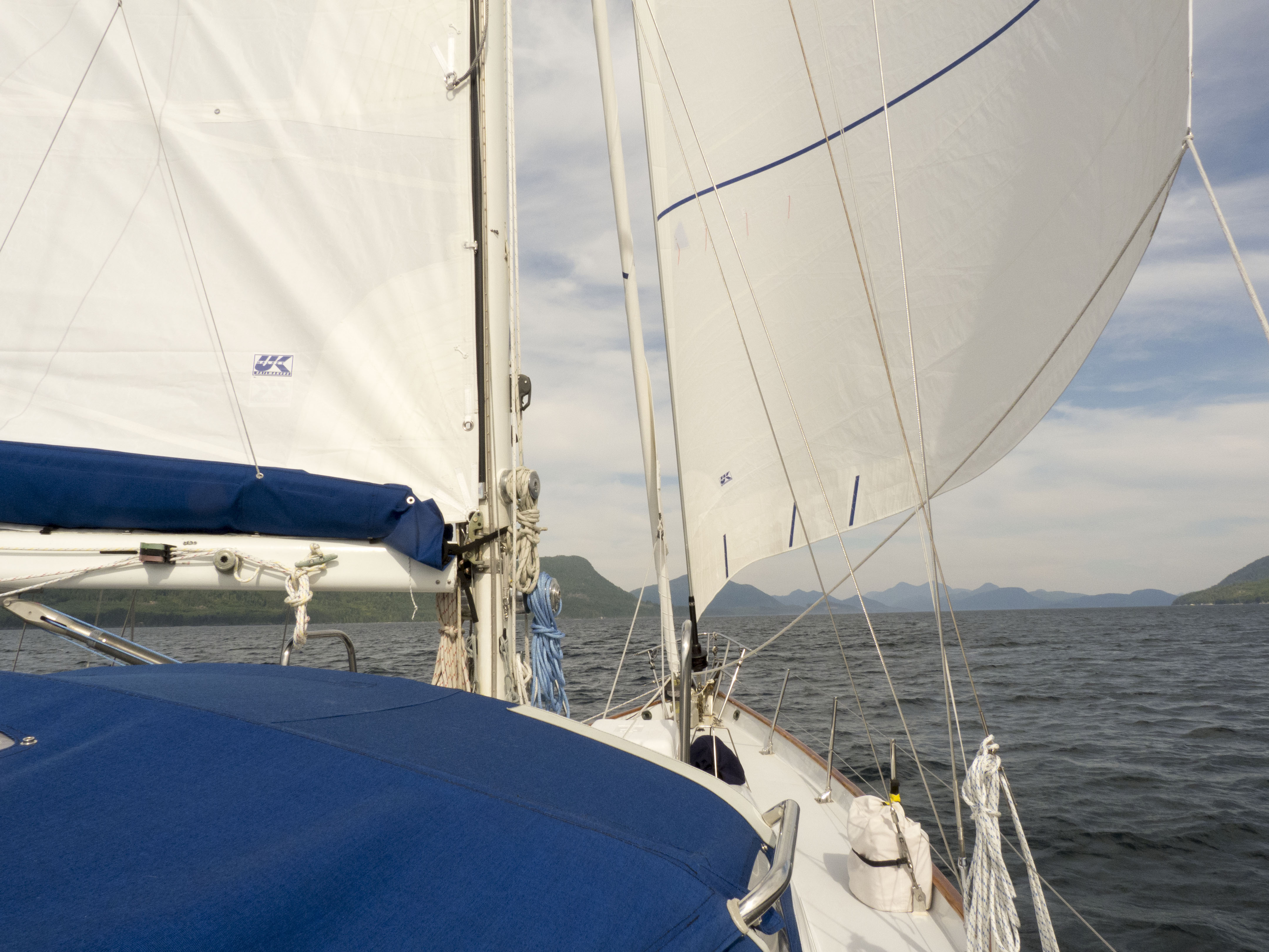
The full moon, the wind, the whir and clatter of the windmill and the half-dream chatter of our thoughts plait into an insomniac braid. We are back in the shadow of Vancouver Island, after an extraordinary 70 mile voyage from Pruth Bay today, most of it under sail. Fast, the boat thrumming at hull speed, singing, surfing the waves before a northwesterly wind.  Humpbacks rolled alongside us early in the voyage and sea lions inspected the bow once we were in Queen Charlotte Strait.  You look; you think “it’s a log and we’re going to hit it;” suddenly there’s a face and then a dive.  The sea lion resurfaces, looks sharply at us and dives again.  Still later we saw another sea lion being pecked and pursued by gulls–suddenly it heaved its bulk up out of the waves and snarled at them, waved a flipper, dove, but still they kept after it.

something goes splash

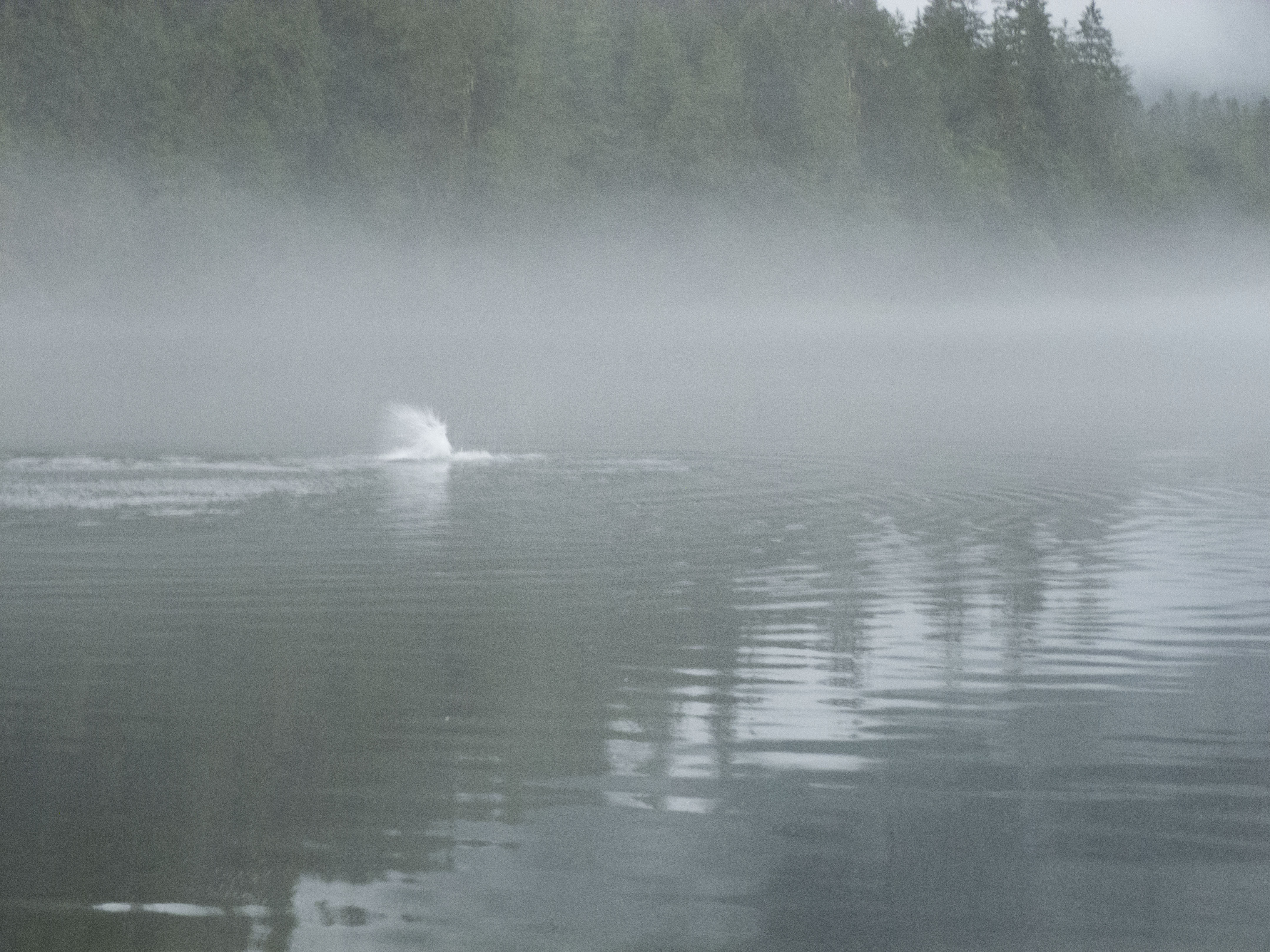
Something goes splash in the fog

The wind was supposed to have died down this evening but it seems not to know that–some larger vessel, a tug or a fishing boat perhaps, has tucked in behind the island and its very bright light swings in the night as we all yaw in the wind. We peer into the night with a flashlight but it can’t probe the darkness or outshine that light, so what swings behind it remains blank. Dark. Unknown. Our own thoughts are almost as obscure. 

P1100779

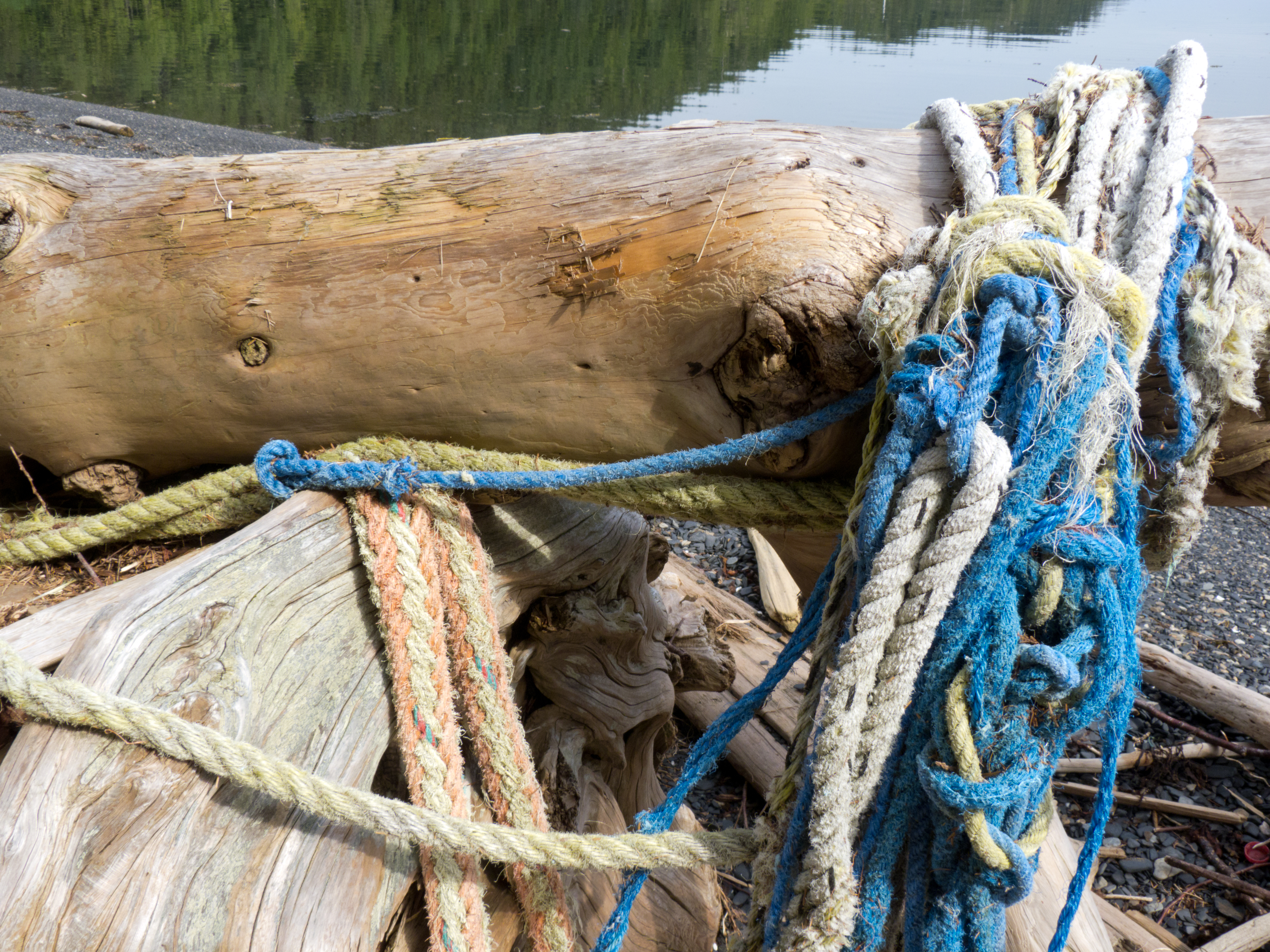
Tangles of fishing line snarled in drift logs on Nigei Island

We’re up, but why? Is it just the wind rattling us? No. It’s the fact that we’ve crossed over, passed through the Queen Charlotte Strait; we’re only a few days away from a stopping place now.  There are airline tickets to book, tasks to schedule, rafts of projects to catch up on, a shift that will have to take place in our thoughts from ‘here’ to ‘there’–which will soon enough be a ‘here.’ We don’t want to rush it, so try not to peer too deeply or let ourselves get too inhabited, yet, by the relations of the land we must till more closely again soon. 

queen charlotte strait in fog

Fog over Queen Charlotte Strait

A sudden feeling of claustrophobia this morning as the fog closed in around the foot of Calvert Island.  It cleared and then closed in again for a time around Egg Island (as always–this surely must be one of the foggiest islands on the coast)–in fact we decided to cross to the west side of the Strait because Nigei and Hope Islands seemed to be in clear light.

Screen Shot 2018-07-15 at 2.02.48 PM

Route sailed from Pruth Bay, Calvert Island, to Port Alexander, Nigei Island

Yesterday as we were walking the beaches at Hakai, we wanted just to go on, to stay, to embark on new water-borne projects; we were full of ideas and sunlight and crashing waves and expansive possibilities.  We feel as if we’re just getting started; it seems to too soon to turn back. But then too, the other parts of our lives beckon.  We miss the dog and the cat and the clarity of the August light in Nova Scotia, the ease of living in a house on the land.  We’ll be back, but it seems forever from now. 

We look up from our middle-of-the-night vigil. The fog is clearing. The moon is bright, so bright we think we can hear it sound upon the water.


IMG_8166

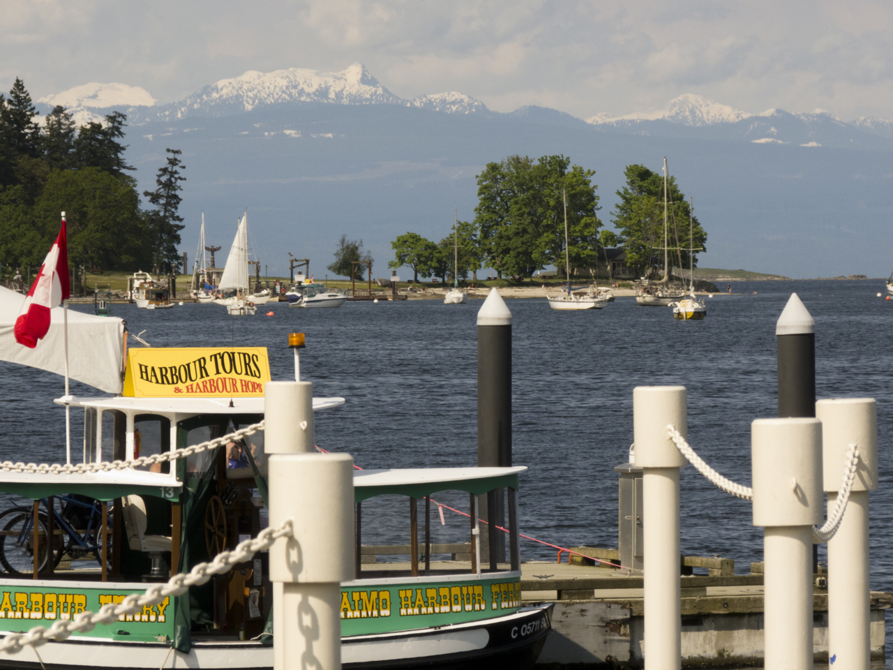
Nanaimo Harbour anchorage at night

12 August 2012 Nanaimo Harbour

We return to Nanaimo and every other return from every other summer washes over us. The headlong rush from watery wilderness, wind, a certain coolness, the sound of birds crying or calling dumps us into heat, diesel fumes, voices chattering and laughing, sirens, flashing lights, clearly demarcated borders and limits, bridges arches ferries dock, ribbons of highways, the stench of tar, screeching tires, beeping demanding telephones and messages. It’s like crossing a border from a world in which your thoughts and actions count, into one in which you are pure reactiveness. The shift is both painful and exciting.

sailing back to nanaimo 2012

Speeding, “wing on wing,” across Georgia Strait

We bombed in under sail after a glorious crossing of the Georgia Strait, clocking speeds of 10 knots and more, speeds we’d never have imagined, and the din of activity around us is overwhelming. One ferry crosses the path of another; a third intercepts them from another point; small boats flit hither and yon; other sailboats weave in and out of various passageways.  The buoys blink red and green; a barge stacked high with crushed car bodies is anchored in front of a large log boom tended by two tugs; a float plane starts towards us and then stops, turns and heads the other direction into a takeoff, while another plane lands behind us and taxis to its dock. Meanwhile a kayaker runs along close to land; the harbour police are out and voice shouts on the radio, “Hey slow down!” “Reduce your speed in Nanaimo Harbour to 5 knots or less!”

P1020948

Nanaimo–view of Newcastle Island

The anchorage is full; hundreds of boats of every sort and from many ports are anchored here.  We recognize a few: the well-kept ketch with the couple and four dogs; the enormous low elegant yacht from the States. The Newcastle Island ferry whips by our bow and its passengers wave; one takes a picture.  We’re part of their tourist experience now.  Authentic sailors, anchored in the port. People who have been to sea.

And we have, and it has changed us.  We’ve come back with a different view of the world–and our competencies.  Nothing will be the same again; from this point we will forever dream of a return to BC’s wilds. And next year we will come and angle further into waterways we don’t yet know and can hardly yet imagine.

otter eating crab 1

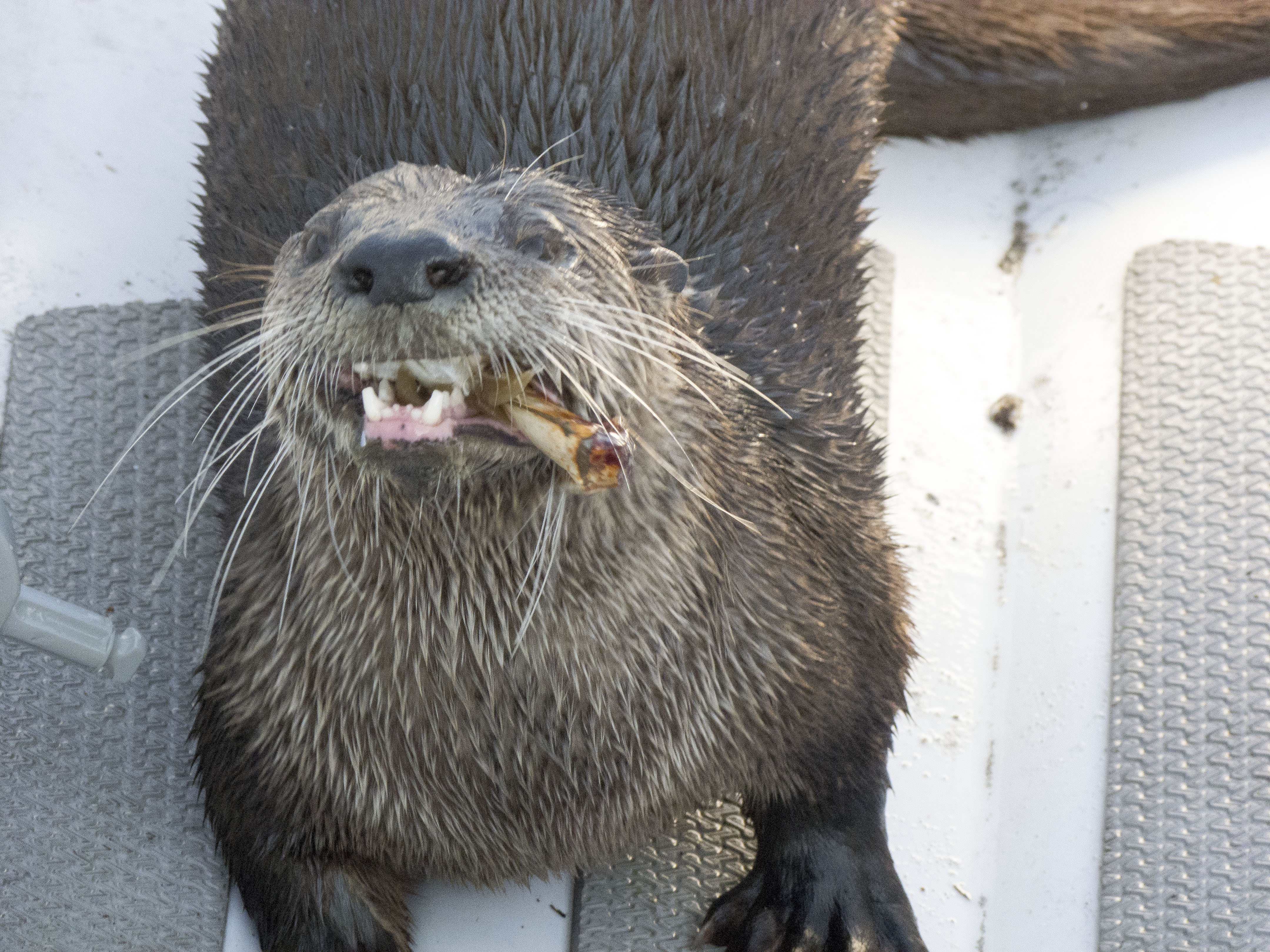
Our last morning at anchor an otter decides to use our dinghy as its dining table

Posted in 2012 | Tagged , , , , , , , , | Leave a comment

Thinking about Rural Coastal Communities with the Hakai Beach Institute

Lama Passage

In Lama Passage passing the Columbia, the Alaska ferry

2-3 August 2012 Pruth Bay, Fitz Hugh Sound

We met our friends, the young kayakers from Juneau again, on a rainy day in the laundromat in Shearwater. They too had stopped here to clean up and reprovision.  Finally, clean sheets, fresh fruits and vegetables, dry socks! We packed the boat with groceries, (Karin had been baking so much bread that we needed more flour,) and topped up on fuel and water. Time to head out, down the Lama Passage again, to Fisher Channel, and then Fitz Hugh Sound.  We saw the kayakers one last time, flung out across a steep beach along Lama Passage.

Alaska kayakers

Alaska kayakers on the beach

Blue skies and a perfect breeze.  We reached speedily down Fitz Hugh Sound, then seven miles up the  narrow Kwakshua Channel that cuts deep into Calvert Island, into Pruth Bay.  As we entered the channel we saw many vessels trolling for salmon.  The fishing was supposed to be good, but it didn’t look as if anyone was catching much.

Sailing the Central  coast

Quoddy”s Run on the Central Coast

Still, it was a beautiful sunny afternoon.  Around us, low cliffs. We had entered a glacier-carved channel where scrappy windblown spruces clung to crevasses in the steep rock walls, and erratics dotted the heights, as if placed there by giants. It looks like Nova Scotia! Marike said as we motored into Pruth Bay after taking down the sails. Indeed it did.

Hakai Beach outcrop


Hakai Beach rocks

We dropped our anchor, lowered our dinghy into the water and paddled towards shore.

A low tombolo separated open sea from Pruth Bay and Kwakshua Channel; on that bit of earth sat a large red-roofed lodge and a series of dwellings, once part of a fishing lodge, but now the site of an unusual undertaking called the Hakai Beach Institute.  Impressive docks fronted the place; moored there were two red-trimmed aluminum motor vessels with closed passenger cabins, the Hakai Express  and the Hakai Spirit, both clearly capable of high speeds in rough weather, along with a series of smaller vessels.  We noticed, as we paddled around the docks, finally tying up where a sign indicated that we might, that all of the services one might wish at a dock–water, electricity, and fuel–were run along the dock in closed pipes; it was the tidiest, sturdiest bit of dockworks we’d ever seen. Signs on the walls of a little gatehouse on the dock greeted visitors and explained how they might access wifi services.  We’d heard from other sailors that free wifi was available here, but by this time, we’d lived so long without the internet that we thought it could continue to wait.

Hakai lodge

Hakai Beach Institute lodge

We walked up the ramp to land, where signs suggested we should enter and sign in at a small house with a notebook, sign in sheets and a computer.  We signed in, and then studied the map for the route to the beach.  Along the way, we walked through well-kept gardens, past the red-roofed lodge and several stand-alone houses, across a bridge and into the trees, then through a clearing filled with several yurts containing beds and tables and chairs. The trail wound through tall grasses and bushes and silver snags here and there, and into the trees again—Sitka Spruce, regrowing after these shores had been scoured of the trees by the aircraft industry during the course of World War II (think the Spruce Goose). Then there was the beach, glowing in the late afternoon.

Eagle, silver snag

Eagle with silver snag

A long sandy spit at low tide.  The sun slowly lowering in the west over many jagged islets. Birds wading in the shallows, kelp strewn across the beach.  Numerous steep rocky outcrops, like those we’d seen at Los Frailes, in Mexico, where the surf had first knocked us down and rolled our dinghy, years ago.  In the cracks at the base of these rocks was a riot of colour–purple and orange sea stars twisted together, and green aggregating anemones eating crabs.  Ospreys circled overhead, while an eagle watched us from her perch in the top of a tree on the top of one of the steepest stony outcrops.

kelp on the beach

Kelp on Hakai Beach

We were in a stunning and clearly sacred place.

Hakai Beach

Birds wading in the shallows

Before we returned to our boat, we made an appointment to come back the next morning and interview the founders and owners of the Institute, Eric Peterson and Christina Munck.  Eric invited us to the lodge for breakfast and lunch while we talked with him.  We met in the first floor of a vast two-storey hall decorated with First Nations and local artists’ works and equipped with a kitchen that served tens of thousands of healthy, gourmet meals each year.  The food was indeed delicious, the abundant fresh fruits and greens a welcome sight to long-distance sailors.

Hakai Beach

Sun star on the beach

Peterson and Munck had backgrounds in healthcare, specifically diagnositic imaging, and botany, and they were interested in environmental management and land conservation.  They had become passionate about how best to deliver health care in poorer countries, where, as Peterson said, “all of the equipment and supplies in the world won’t do any good if you don’t have competent people in place.” They started a family organization they called the Tula Foundation; its first aim was to enable the delivery of primary nursing care in key communities in Guatemala.

sea star with aggregating anenome

Sea star with aggregating anenome

Meanwhile, Munck had started to work on the Central Coast with the Nature Conservancy. Her interest had been in securing land that had been abused industrially, but that had high enough “ecological attributes” that it might be recovered and made usable again. She had gotten involved in sorting out what to do in Rivers Inlet during the collapse of the wild salmon stocks.  Rivers Inlet had had the third largest salmon runs, after the Skeena and Fraser Rivers, but it was the first large salmon fishery in BC to collapse. This devastated the Oweekeno First Nation, now a fishing people without fish or boats.  During the course of conversations about what sort of science or new undertakings might happen in the wake of the collapse of the fishery, one elder remarked to Munck and Peterson that his community was in need of primary nursing care too.  Suddenly it began to seem as if all of their interests—in science, healthcare delivery, and ecological recovery—might be converging. They began to look for a base around Rivers Inlet, an old fishing lodge perhaps.

Hakai Beach kelp

kelp fan

Indeed, Munck had once visited Hakai while it was still a fishing lodge for a conference,  and was stranded there by bad weather. She fell in love with the place, with its access to the protected waters of the inside passage, as well as the open sea, and with its mix of wilderness (wolves on the beach!) and a history of human uses, including its status as traditional territory and an important sacred place to the Oweekeno and Heiltsuk First Nations. When the lodge was put up for sale in late August 2009, she and Peterson bought it, and began to establish the Hakai Beach Institute. “We are stewards of this place,” Peterson told us. “We don’t really own it.  We provide a neutral meeting ground for members of the four First Nations of the Central Coast (Oweekeno, Heiltsuk, Nuxalk and Kitasoo/Xai Xai); we use our boats to bring people together to meetings.”

We recalled seeing one of the Institute’s boats speeding through the southern end of the Grenville Channel. When we mentioned that, Peterson said, yes, that was some elders from Hartley Bay we’d picked up.

Hakai Beach sea stars

sea stars dancing

Since 2009, the mandate of the Institute has expanded so that it brings together members of the First Nations, university researchers, government agencies,  and the Coast Guard.  The place thus engages teaching and research in a variety of areas from scientific monitoring of climate change and marine fauna, to archeology, the earth sciences, and the arts.  As a stewardship zone, the Hakai Beach Institute has provided a neutral, casual meeting place for First Nations people from communities in Bella Bella, Bella Coola, Klemtu, Rivers Inlet and Hartley Bay to get together to strategize around key issues such as the Northern Gateway Pipeline, or how to further protect important species such as the Spirit Bear.  According to Peterson, traditional enemies sometimes find that a casual encounter at Hakai with good food, trails, beaches, and facilitation, can lead to reconciliation and agreement on some key issues.  Hakai has provided leadership training for First Nations youths, and has begun to expand the network of Coastal Guardian Watchmen begun in Haida Gwaii.  Hakai also collaborates with Parks BC in order to carry out basic science and monitoring and to build trails and boardwalks along the ocean side of Calvert Island.

Coastal Guardian Watchmen Network

Coastal Guardian Watchmen Network

Peterson was especially proud of the physical plant of his Institute.  He described himself as a “city manager,” and gave us a tour of the waste and electricity systems of this off-the-grid ecological village which employs 20 staff members on each rotation, as well as housing its owners, visiting scientists, and others.  Hakai is an experiment in green technology and recycling: even the grease from the kitchen is disposed of through microbial grease eaters, and then becomes compost for the gardens.  The electricity plant is increasingly solar, taking over from generators.  Power is stored in huge battery banks, and a state of the art water purification system is set to go online this year.

We enjoyed our conversation with Eric Peterson; perhaps most of all, we were engaged by his musings about how the Central Coast was not a pure wilderness, but rather bore the traces of a time when the area was more densely populated.   The land had been greatly culturally modified over centuries, not just by now defunct freeholder fishing, or hand logging, and mining industries, but far earlier by First Nations clam farms, as evidenced by middens, and forest cultivation.

sea critters

Sea stars, aggregating anenomes, crab bits

We were struck by the resonances between our observations, what Peterson had been saying and what we had been reading in a book entitled the Last Great Sea by Terry Glavin.  There Glavin marshals an abundance of archeological evidence to suggest that, contrary to what many of us have been taught, the First Nations of the North Pacific rim were never nomadic hunter gatherers who, on some date after the last ice age, marched across the Bering Strait and then spread across the Americas. Rather, the specific character of Pacific coasts and various Pacific First Nations  communities from Japan and the Koreas to Alaska and British Columbia, suggest that coastal dwellers have been mariners, and seasonal farmers of both sea and land for the last 9000 to 12,000 years.  There is evidence of clam farming, permanent settlements around these clam beds, habitations, art works, and short migration routes along the coasts and islands following salmon and oolichan runs, and other seasonal foods. There is also quite a lot of archeological evidence of trading between these First Nations and others, both to the West and in the North.  Salmon fishing technology more than 9000 years old—a small grooved stone sinker for a salmon line–was found in Namu, on the Central Coast, “the oldest known piece of fishing gear in British Columbia….”  Glavin says (32). Beneath that find was more human detritus. As Glavin reports, “The antiquity of the site established Namu as one of the first fishing villages anywhere on earth” (33).

Marike walks on the beach

sunset on Hakai Beach

Human cultures in the North Pacific were shaped not only by the sea, Glavin argues, but, overwhelmingly, as even the landscape itself was, by salmon. The abundance of the salmon made for bountiful, massive forests and human societies of great richness and development:

“North Pacific cultures were composed of  self-sustaining, densely populated societies marked by rigid hierarchy and social rank, based in large, permanent winter villages. And nowhere else on earth were human societies so fully integrated within marine ecosystems. Nowhere else were people so dependent upon fish. Among some North Pacific cultures, the isotopic signature found in human remains is exactly the same as that found in dolphins.

“The next thing you see is salmon.

“From the very beginnings of human history in the North Pacific, salmon were involved. Salmon were there at the close of the last ice age, and for most of history since then, salmon—not human beings-were the species most responsible for altering the shape and form of the continents around the North Pacific….Every year, millions of tonnes of energy was brought up out of the depths of the North Pacific and deposited deep within the continents surrounding it…” (Glavin 9-10).

In fact, as we had been sailing along this coast,  the three of us had read a number of other books loaned to us by Dawn Burkmar, part of her now two-year project to educate us about the land and history of her beloved British Columbia. Most of them pointed to a much more crowded, inhabited coastline than the one we found. Here, as in Nova Scotia, the coming of white settlers had destroyed First Nations health and communities. Then increasing mechanization, urbanization and the arrival of huge commercial fishing and logging operations diminished and destroyed the white settlements scattered along the coast, leaving behind ghost towns, rusting ruins and timber that rotted and returned to the forest.

Dawn's BC Books

Books from Dawn’s BC library

We read Up Coast Summers, by Beth Hill, which compiled the journals and photographs of Francis Barrow, and described summer voyages in the 1930s and early ‘40s from the Gulf Islands to the Broughton by Francis and Amy Barrow, amateur archeologists.  They were constantly stopping off in various  communities to visit with settlers along the coast or making detours for social gatherings.  Three’s A Crew, by Kathrene Pinkerton, described cruising the coasts of British Columbia and Alaska in the 1920s and 1930s.  We were struck by how many people living along these coasts were involved in sustainable farming, fishing, logging or commerce.  There was a hospital ship–the Columbia—that ran the coast and visited each port.  People knew each other, welcomed voyagers, and shared food and news.  A young woman, Betty Lowman Carey, upon completing her first year of university, paddled a dugout canoe she called Bijaboji, after her brothers Bill, Jack, Bob and Jimmy, from Puget Sound to Alaska during the summer of 1937. In her memoir, Bijaboji, she, too, recounted stopping off in many places where there were families and gangs of loggers or fishermen and women.  The boat traffic up and down the coast seemed to be fairly regular, and included supply vessels, the hospital ship, and an American Scout training ship.

Even more recent accounts like Alexandra Morton and Billy Proctor’s book, Heart of the Raincoast and Proctor’s second book, co-authored with Yvonne Maximchuck,  Full Moon, Flood Tide, about the Broughton of Billy’s childhood and young adulthood, both attest to a time when that part of the coast was far more active and inhabited than it is now.

Hakai Beach Rocks

Marike and Karin on Hakai Beach

This is also true of the place where we live in Nova Scotia, the Eastern Shore. It is also a place of First Nations middens, and white settler coastal communities once far more connected to distant places and much more populous than they are now. Before the highway went through in the 1960s, the Okay Steamship stopped in communities along the coast to take passengers, fish and provisions to and from Halifax.  The islands in the Bay of Islands contain remains of little houses where the fishermen would stay once they rowed out to their grounds.  A fishing smack would motor around pick up their catch each day and take it to the canneries or to a larger vessel to get it to market. Now those canneries and fish plants are all gone, the cod fishery is dead, and schools and churches and communities are shuttering, as their older inhabitants die, and the family houses tumble from their stony foundations.

We were very interested to find that Eric Peterson had been thinking about the Central Coast in ways that resonated with our own reflections on rural coastal Canada as we’ve encountered it on both east and west coasts. The work of the Hakai Beach Institute, its emphasis on how human and natural histories intertwine, fits right in with other research that we have been doing on the depopulation and corporate exploitation of marginal rural areas in this country.
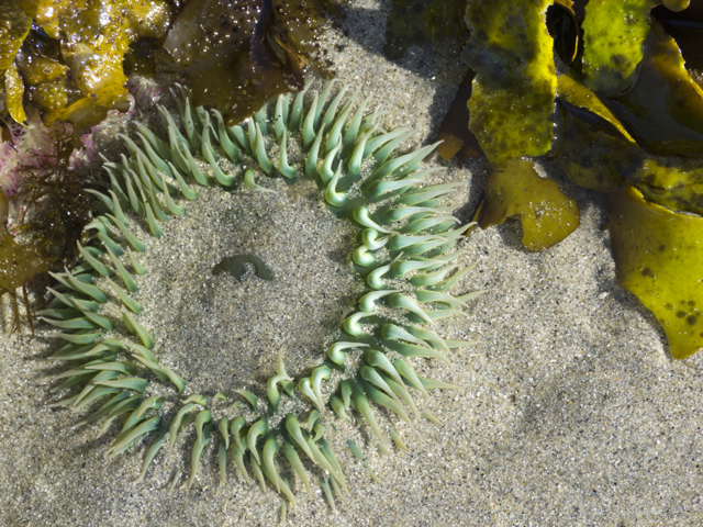
Hakai Beach anenome

Aggregating anenome eating a crab (and full of sand)

As we were ending our interview, a boat full of children from Bella Bella, supervised by a young woman who had taken the youth leadership course at Hakai, arrived for a day at the beach.   We too were eager to return to the beach once we had fetched Elisabeth.  At low tide we took a long walk to several other beaches connected by trails and boardwalks.

We had no trouble understanding why Hakai Beach and Pruth Bay in the Kwakshua Channel, is and has been for centuries, a sacred place.

Pruth Bay at night

Pruth Bay at night, looking out Kwakshua Channel to Fitz Hugh Sound

For more on the Hakai Beach Institute, see http://hakai.org/


Posted in 2012 | Tagged , , , , , , , , , , , , , | 2 Comments

Don’t anchor near the outlet of a lagoon and other lessons from Kynoch Inlet

P1090957

29-31 July, Kynoch Inlet, Fiordland Conservation Area

We weighed anchor in Bolin Bay on an ebbing tide and sailed up Sheep Passage, doglegged into Mathieson Narrows, and then into Kynoch Inlet, a true deepwater fjord, where the fog laced steep granite faces and snowfields.

Kynoch Inlet is the historic homeland of the Xai’Xais First Nation, which moved to Klemtu around 1875 to join with the Kitasoo Nation there, after both groups had been devastated by disease.  Klemtu was chosen as the site for their joint village because of its proximity to shipping routes.

Elisabeth in Fiordland

Elisabeth takes a picture in Fiordland

Since 2006, Kynoch Inlet has been part of the 91,000 hectare Fiordland Conservation Area and recently, nautical charts for the area have been updated.We were glad because we knew we wanted to go there.

As we motored into Fiordland, cascades tumbled down thousand meter granite cliffs. Thousands of birds gathered in the trees and on the water; the water was black in the fog and drizzle, the air chilly. But we didn’t care. We were in thrall of this vast landscape; we kept popping out of the protection of the cockpit to stand in the mist and take photographs.

Fiordland granite

Fog wreaths granite faces

We motored slowly up into the inlet—there was no wind that day—pushing birds aside with our bow wake. The marbled murrelets scooted away, bobbed underneath the water and popped up again nearby.

Kynoch Inlet

Head of Kynoch Inlet

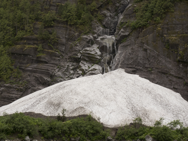
When we reached the head of the inlet we saw a narrow marshy area filled with yellow grasses and white birds, a winding river pinched by a steep bank, then a narrow opening into Culpepper Lagoon—we’d been told you could anchor in there. A large trawler and a ragged Alberg 27–aptly christened “Scrapper”–were anchored some distance to either side of the passage into the lagoon.  Elsewhere, steep stony margins separated sheer mountains from the sea; every surface was tinged with green in the afternoon drizzle.  On one shore, at sea level, was a gigantic mound of snow, large as an iceberg; we could see where it had tumbled from the mountain top. Frost rose from the snow pile; the air felt distinctly cooler here than anywhere else we’d been.  We motored around for a bit, searching for the edge of the marshy shelf to one side of the lagoon, and finally dropped the hook in what seemed a satisfactory place.

Marsh, Kynoch

Marshy area, Kynoch

We saw a young lad rowing around the Alberg, waved, and he came over to talk.  He was English, on his gap year, although he said “he didn’t like to call it that.”  He told us he’d seen grizzlies–a mother with a cub–and heard wolves along the river. We asked him about the lagoon and he looked over our boat.  You might want to move anchor, he said in a musing tone. There will be something like a river that runs through here when the tide ebbs out of the lagoon. Then he shrugged—Oh I guess it will be okay, he said.

Snow mound, Kynoch

Huge mound of snow. How huge? Those brushy green things are large trees.

Still overwhelmed by our good fortune, and our freezer overstuffed, we gave him some halibut, which pleased him. And then he was off, back to his boat to read.  We debated for a bit if we should move, but we didn’t. We’d anchored in front of a falls in Lowe Inlet, and in very deep water in Bolin Bay. It seemed that we were far enough off to the side of the entrance to the lagoon not to worry, and so we didn’t.

cascade into the snow pile

Cascade above the snow pile

The people on the trawler were from Campbell River, on Vancouver Island.  They puttered by to greet us, interested in a boat whose port of hail was Lunenburg, Nova Scotia.  We chatted for a long while about the differences between the east and west coasts, about landscape and scenery, art and fishing.  Finally they asked if we had crab traps; evidently they were catching excellent crabs in this harbour.  When we said no, we didn’t, they insisted that we fish one of their traps, which they handed over to us, baited and ready.  Then they snuck into Culpepper Lagoon for the night.  Like or not we had become crab fishers.

Kynoch lupins

Lupins near the snow bank

It was chilly outside, so as evening fell we read and dined below decks, coming up now and then to listen for the wolves.  Exhausted by the cold, the fog, and the drizzle, as well as the prospect of returning “to land,” we went to sleep early.

Karin, a worrier, woke at 2 am to the sound of water rushing by the hull.  The anchor chain began to rattle and bang as the big metal hook on the anchor bridle bounced against the chain.  She went above decks to see what she could see, but it was so dark and so foggy that she felt completely disoriented.  Where were we? Where was the little boat with the English chap who’d said it would feel like we were anchored in a river? Why hadn’t we listened to that?

She turned on the chart plotter, calculated the distance we were riding from where we had set—267 feet, the outside edge of the same circle, so no, we hadn’t dragged anchor.

She sat in the dark for awhile and watched until she got her bearings, listening to the water rushing by.  We were indeed in a river. She decided to go forward and check the anchor: the bridle was pulling hard and a huge ball of seaweed had mounted up on the chain.

Karin’s footsteps on the deck woke Marike. What are you doing alone out there? Marike demanded.  Make sure I’m awake and know where you are before you go on deck!

She was right of course. “Do not leave the cockpit unless someone knows where you are” is one of the basic rules of sailing, especially at night. The water was just 8 C in Kynoch Inlet and the current was rushing by. If Karin had tripped and fallen overboard, that would have been it.

Now Marike was up, and the current was picking up. The chain rattled harder, the bridle lines creaked and pulled at the bow cleats. The boat swayed and moved, the propeller began to turn, the hull shuddered.

Karin got out the tide book and began to calculate when the current might begin to diminish: by 4 am, she thought; the tide change is just after that.  But it was not so; if anything, by 4, the current had sped up.

We sat up, and watched and listened and waited. We got cold, and wrapped ourselves in blankets. Marike turned on the knot meter, which measured how fast the water seemed to be flowing by: 2.5 knots, 2.8, 3.1, 3.7. Rattling and rattling and whirring of the propeller and then bit by bit an easing of noise, tension, current readings.  Maybe we can go to sleep, we thought; the worst is over.  And then Marike looked at the chart plotter and said, we’re in 92 feet of water, could that be?

Oh no, definitely not, Karin said, racing up onto the deck. We’ve dragged!

The water was too deep to be sure the anchor would set itself properly again, so we woke Elisabeth (who, being hard of hearing, had slept through all of the commotion), started the engine, turned on the windlass, decided where to re-anchor, got our bearings in the dark (thanks to the huge patch of snow on the nearby shore), and hauled up the chain. Then we crept about confusedly in the dark, found the spot where we thought we wanted to be (glory be to chart plotters and GPS—you can fly by instrument if you must), and dropped the hook again.  0.0 current. 5 am. Light was just beginning to brighten the sky behind the mountains.

Quoddy's Run, snow, Kynoch

Quoddy’s Run reanchored nearer the snow

We went back to sleep and slept late, then had a big breakfast of blueberry buckwheat pancakes with bacon and eggs.  Lesson learned: we won’t do that again, set the anchor in the outflow area of a narrows or lagoon.

Red throated loon

Red throated loon

The day when we clambered out was quiet, the sky still overcast, the air near the little snow glacier running into the sea freezing cold.  It seemed that the marshy flats stretched out almost to the boat. Karin spotted a red throated loon, and  the seagulls and seals were feeding with fervour, splashing wildly near the shore.

Marsh Kynoch

Birds flying out of the marsh

The trawler came back out, fished their crab trap for us, giving us the eight crabs they hauled up.  Like us, they hoped to see this place in the sun.  Dan was a marine artist, Wendy told us, and wanted to paint Kynoch beneath clear skies.  Not this year.

Culpepper Lagoon mist

Mist coming out of the lagoon

Time for an excursion. We dressed warmly—it was the only time we needed our long johns all summer–and dinghied over to the enormous mountain of snow.  Then on to the estuary by the shallow shelf.  At slack tide we dinghied into Culpepper Lagoon, cautiously, lest the tidal rush start again and trap us inside with our dinghy.  It was a perfect hurricane hole in there, utterly quiet.  Neither radio nor telephone worked in these zones: the crevasse of fjord between mountains was too narrow and too steep even for the single sideband radio. Incommunicado. Tall trees, green water, loons as tame as though this were an arctic Galapagos.

Kynoch Inlet

Headed out of Kynoch, in fog

Such solitude was perhaps too much even for us.  We used our fire ax to slay the crabs onshore, hacking them in half and dumping out the stomach, offal and lungs, then washing them in the water. We offered some to our young Brit, but he wasn’t fond of crabs. So we steamed them, ate as many as we could, picking the meat from the rest for another day.  Then we readied the boat for an early start to Shearwater.  Like Dan Telosky, the painter we’d met, we’d be back. We’ll hope for a sunny day.

Notes

http://www.env.gov.bc.ca/bcparks/explore/parkpgs/fiordland/

www.dantelosky.com

Posted in 2012 | Tagged , , , , , , , , | 3 Comments

Halibut fishing and whales singing in Bolin Bay

Steep mountains

Quoddy’s Run in Sheep Passage

28 July 2012

Where Sheep Passage bends north between Pooley Island and the mainland, steep mountains run down to the sea.  We were aiming for Bolin Bay for the night, a narrow slit between mainland peaks, named, like many of the smaller inlets in the area, after a young soldier from BC who had died during World War II. These English names (First Nations’ place names rarely make it to our maps) were still all about commemorating wars of territorial expansion, colonial conquest and repartition: at least, however, they weren’t about settling English naval battles or nineteenth-century “great men” onto a landscape they had known nothing about. Had Bolin ever been to Bolin Bay? It seemed not, but at least he was a British Columbian.

By late afternoon, Bolin Bay was already dark, shadowed by steep mountains with sheer rocky faces.  The dark cliffs towered above a stony fringe of beach; behind the beach a mountain lake fed a river and a small lagoon surrounded by grassy flats.  Waterfalls and the sound of running water were everywhere; snow was still piled in the hanging valleys overhead.  Now and then the clouds pulled back far enough to reveal broad snowfields, then a line of granite peaks against the sky.

near Bolin Bay

Clouds hide peaks near Bolin Bay

The cleft where we anchored was dark, deep and vast.  We found a shallow spot of 75 feet to set the hook, and that seemed very close to shore, though the enormous scale of the place contributed to that impression.  We imagined we would see grizzlies and wolves here along the grassy flats—indeed, when we were anchoring, three small metal boats roared in and everyone aboard them jumped up and began staring at the shore.  Were these grizzly watching boats?  We could not see what these people were looking at, nor really where they were from. No one lives anywhere nearby save the few workers at the massive Ocean Harvest feedlot operations that seem to be creeping up Sheep Passage.  One man started howling like a wolf; everyone on the three little boats stared at a spot on the shore a bit more, then they climbed back inside their boats and roared away.

Loon

Loon in Bolin Bay

Loons and Bonaparte’s and Mew gulls were all around; fish were jumping, but not salmon. We saw eagles and ravens but not bears, not wolves.  It was peaceful, beautiful.  Karin scanned the beach with binoculars, Elisabeth settled some things down below, and Marike began to fish. Again. Although, in truth, she was about to give up fishing altogether.  It seemed obvious fishing was not one of her great talents; she hadn’t had a bite since Viner Sound. Still jigging could be relaxing, especially while waiting for the rest of the crew to get themselves organized. It gave a body something to do.

Bolin Bay

Rocky beach, Bolin Bay

But after ten minutes, nothing had even nibbled at the line. This was hopeless, Marike thought.  No sense carting all this gear around on the stern. We should get rid of it the next time we were at dock.  Feeling a bit defeated, she started to reel in the line. This was it, this would be the end.  Suddenly the line snagged.  Darn, she thought, she was caught on the rocky bottom.

gull preening

Bonaparte’s gulls, Bolin Bay

But then the rocky bottom started to pull back hard, really hard!  Really really hard!  Harder than anything Marike had ever had on the other end of fishing rod.  She shouted out to Karin and Elisabeth, I’ve got something big! I’ve caught something. They came rushing over. Indeed she had; the rod was bent double, the line running out.

Maybe it is a salmon, Marike thought.  Maybe she should pay out the line, play it or the fish will break the line and get away.  Suddenly it seemed as if the line were going to run under the boat.  Don’t let it do that! Karin yelled. Stop that fish before it wraps the line around the rudder or the propeller!”

Bonaparte's gulls 2

Gull flies away

With all of her force, Marike began to reel in like crazy.  Whatever was on the other end fought and thrashed and finally broke the surface. It was still for a moment and then began thrashing again.  A halibut!!

Halibut 1

Halibut in a net

Marike hauled up on the fish and Karin leaned over the lifelines and, and after a false try or two, succeeded in scooping the fish into the net. Now there were two of us holding the thrashing fish up out of the water against the hull, Marike with her line and Karin with the net. Stories of halibut breaking everything around as they fought for their lives ran through our heads. Elisabeth got the shot hammer and Marike took aim.

halibut 2

Netted halibut

But where is the brain of the halibut?  Because the fish is flat, with one eye that has migrated over so that both eyes are closely set and near the top of the head, it is hard to figure out where a halibut’s brain is. Not between its eyes. Marike clubbed the fish on the head hard a few times. It put up a good fight, but  soon it was clear that the halibut was dead. We had to cut the line to disengage our pole—that halibut had swallowed our hook, that’s why it hadn’t managed to get away.

Squeamish as usual about washing the decks in fish blood, we decided to fillet the beast on shore.  While Elisabeth held the net, Karin and Marike lowered the dinghy and gathered knife, sharpening stones and oil, and a bucket for the fillets.  Then Elisabeth photographed, while Karin and Marike rowed to shore, dragging the heavy beast in the net in the water.  They found a place with large flat rocks, dragged the dinghy up the beach and the fish to the rocks; then, while Karin carved, Marike brought over a bucket of water for washing up.

carrying halibut ashore

Marike rows while Karin drags the halibut in the net

A few last death throes after the first cut—halibut are formidable creatures—and the filleting went easily.  Karin’s chief worry, it being early evening, was that a grizzly would amble out of the woods and run us off of our fish.  So Marike kept watch, while Karin separated flesh from bones, feeling her way through an anatomy that, until this moment, she’d only seen in pictures.  She removed two large filets, then cut each into numerous substantial chunks.  Our fish had been at least 25 or 30 pounds—luckily for us, it was small as halibut go. A larger fish might have snapped our pole.  Our tiny freezer compartment would be full.

Eagle halibut carcass

Eagle watches over halibut carcass

Once the fish was filleted, we dragged the carcass to the top of a rock visible from the boat; we wanted to be able to watch the creatures that would come to pick at it. Ravens and eagles surely, but, we hoped, perhaps, a bear.

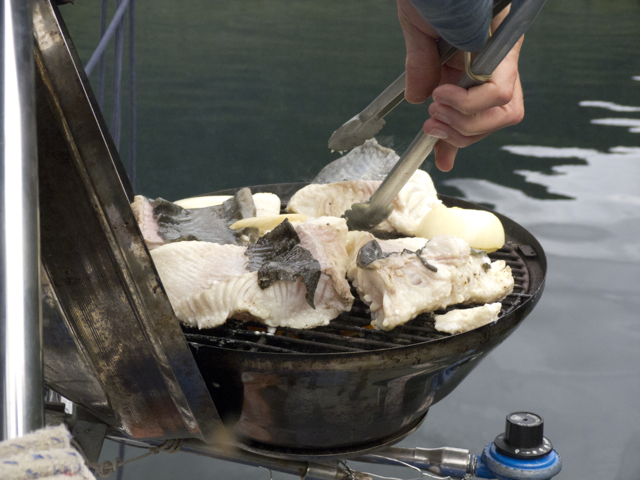
Nothing is so delicious as freshly caught halibut fillet grilled on the barbecue and seasoned with salt, pepper, garlic and a little butter  at the end.  Yes, we had mocked the fishing frenzy, the raging fever that caught so many of the people we’d encountered from Gibson’s Landing to northern BC, but in truth, we were very thrilled by our big catch.  That night we sent a sailmail to our fishing teacher, Rick, asking if we might graduate now. You’re on your own! he told us. You always were! That’s not true of course. Without Rick, we’d never have gotten started. Nor persisted.

bbq halibut

Grilled halibut steaks

Later we realized that we had been anchored in the perfect spot to catch a halibut–at the edge of a ledge that drops off very steeply.  The timing was perfect too, we were at the point of a changing tide.  Halibut like to lurk on such ledges at the tide changes, in order to catch smaller fish that are being washed in or out by the current.  We admit it; we will try again to catch a halibut although we will have to club it to death, not just because we are hungry, but because fresh halibut is exquisitely delicious.

Lagoon Bolin Bay

Rowing in the lagoon, Bolin Bay

After supper the tide was high enough that we were able to row along the shore, into the lagoon and back up into the river until it got so shallow we could continue no further.  Night was falling.

The rain came in the night, a soft patter on the deck. Then the fog slipped in too, drifting and hanging about the shoulders of the mountains like a cape.

Night, Bolin Bay

Nightfall, mandatory mosquito net

The whales came in the night too. At least, that’s what we’re calling this phenomenon, this visitation of strange movements and sounds. There was a gurgling at the through holes, a gentle rocking and slapping, and then the singing began—high pure notes like the music produced by rubbing crystal goblets filled with water.  Then on the other side of the boat a deeper sound, then another in more middling tones. Three voices in call and response, long clear notes, other-worldly and utterly beautiful.

We tried to stay awake to listen but were lulled to sleep. Karin dreamed we’d seen the creatures who were singing. In her dream, they were oddly jointed enormous dinosaur fishes in lovely shades of rust and aquamarine. But when we reported on them, no one believed us; they just went about their daily lives, filling their gas tanks and worrying about which footnotes go where.

We awoke again and heard the music, the slap and gurgle at the hull, a soft bouncing as if something had come up beneath the boat and rubbed against it, then a slow lyrical dance in just a few long notes, echoing and resounding through the hull.

We wondered what sorts of beings were making these sounds and if we could sing back to them, and what they would say if we did.

Once morning came, we stayed in bed for a time just to listen to the eagles sing, almost musically, a high rushing flutter with just a tinge of rust. Pure happiness.

Bolin Bay snow field

Mountains, rigging, mist

Notes

Karin wrote a poem about the whales in Bolin Bay–if that’s what they were, and her peculiar dream. You can find that poem here, along with links to whale songs and crystal goblet music: http://visiblepoetry.blogspot.ca/2013/04/the-whales-came-again-last-night.html

Posted in 2012 | Tagged , , , , , , , , , , , , , , , | 2 Comments

Fast Track Back–Fishery Politics in Northern BC

low clouds sea

Sailing into grey weather

27 July 2012 Klewnuggit Inlet; Butedale

Homeward bound.  The low clouds suited our grey mood: we didn’t want to turn back just yet, but the concerns of our land life were calling; we’d been conquered by the calendar.  At least we’d timed things right and got the push with the tide back down Grenville Channel.  Fog rolled in, then turned to rain as we headed back into Wright Sound; the weather pushing in from offshore up Squally Channel could clearly live up to that channel’s name.

Rain, plotter, radar

Exiting Grenville Channel in rain

We sailed quickly through choppy waters of Wright Sound, into McKay and then Fraser Reach. (Click on the link to watch a 2:25 minute video of Quoddy’s Run sailing in McKay Reach.)

McKay Channel

Elisabeth takes pictures as we sail in the mist

Around us in the fog and damp, we heard the sounds of small sports fishing vessels moving about, motors stopping and starting, voices. Mountains towered over us, their peaks lost in the clouds.  Blue-green light.  By evening, the fog had lifted; by 8:30 pm, we were tied up at the dock at Butedale again.

At dock in the night

Quoddy’s Run at dock in Butedale at night

All day, a parade of commercial fishing boats almost as thick as the salmon they were seeking came back down the Fraser Reach from the Skeena River. Many were hurrying south to try to position themselves for an opening on the Fraser River. (In fact, that fishery would never fully open in 2012 because the salmon counts were so low.)  Some fishermen seemed pleased with their catch, like the antique Finnish skipper and his crew on a stout, sparkling shipshape vessel from Sointula that we helped to tie up to the rickety docks at Butedale near midnight.

night, Butedale

Night in Butedale

Other fishermen were less pleased. A Heiltsuk skipper from Bella Bella whose boat was moored in front of ours told us the government shut the fishery down too soon and didn’t let the Bella Bella fishermen get their share.  He also told us that the Department of Fisheries and Oceans had set up an electric wire and was killing the salmon as they jump back up the river. He claimed the DFO was composting fish carcasses, emptying the river of fish so that there would be no further habitat or wildlife barriers to the oil and gas industries. (In fact, in the fall of 2012, the government removed these barriers by federal fiat, passing laws that removed habitat from the Fisheries Act, and vastly reduced the numbers of waterways protected from industry by federal regulations. These new laws, federal omnibus bills C-38 and C-45, have triggered massive First Nations and settler protests across the country, and birthed the Idle No More movement.)

flash solar panel

Solar panel in the dark

Steven Harper won’t be getting our vote again, the Heiltsuk skipper asserted; people are waking up to what he’s about.  No apologies will fix what he’s doing.  We wondered how many First Nations people really did vote for the federal Conservatives because Prime Minister Harper gave an official apology for the destructive (we would say genocidal) cultural policies of past governments towards First Nations people, and offered a compensation program for survivors of the residential school system, the aim of which had been, officially, to “take the Indian out” of First Nations children.  Did the apologies—a minimum of decency and the smallest of gestures towards taking some historical responsibility on the part of settler governments–really trigger gratitude?

At first, we thought that the story about the electric wire was a metaphor, a way of pointing to and underlining the fact that removing habitat from the fisheries act and other such gestures of the current government were, in effect, wantonly wasting the resources of the wild fishery.  But so was gillnetting, we thought, which was how all of those fishermen racing south by us had been fishing.  Where was the sport in that? Or the “resource management”? But as usual, there was quite a bit going on we knew nothing about. When we met Alexandra Morton some days later on the dock in Sointula, she confirmed that indeed, the DFO did have a management practice of electrocuting smolts in order to limit their numbers and give those that did mature a better chance to grow out. Do such policies really work? we asked. Alexandra couldn’t say.

Butedale Louis was glad to see us again, as was his cat.  We scrounged more rhubarb for another crisp, and later a rhubarb cake.

boat based logging operations

Trailer Princess logging headquarters

We left early the next morning in order to have the tide with us through the Heikish Narrows.  Many more small gillnetters cruised by us as the morning wore on.  As we ran down Graham Reach, we saw an enormous old vessel re-commissioned as a platform for logging operations tucked into a creek bed near the opening of Green Inlet.  It was named, aptly and hilariously, the “Trailer Princess.” Tongue-in-cheek woodsmen.  Clear cuts ripped through the region. With the binoculars, we noted that porters were parked in the bow of the vessel, while houses and offices were stacked in the stern, and a little tug and some other vessels were rafted alongside.   Tolmie Point was cut in wide swaths all along the water.  Beautiful BC! Beautiful cruise ship route! Is anyone paying attention?

gulls ride sticks

Gull catch a ride

Eagles sat in the cedars along Heikish Narrows, watching the salmon jumping.  Two large open pen salmon feedlots were nearby in Sheep Passage.  We wondered if the salmon we saw jumping were wild or escaped farmed Atlantic salmon.  As we passed the fish farms, we  watched a crew power-spraying nets in open water. You wouldn’t get away with that on our coast, but who was watching here? Just us, and what did we know?

moving fish farm cages

Moving fish farm cages in Sheep Passage

illegal water sports?

Divers spray wash old fish pens in Sheep Passage

Posted in 2012 | Tagged , , , , , , , , , , , , | Leave a comment

In Grenville Channel—and the salmon forest

Grenville Channel

Long, straight and narrow: Grenville Channel

24-25 July 2012 Grenville Channel: Lowe Inlet Marine Provincial Park and Klewnuggit Inlet Marine Provincial Park

Grenville Channel is a straight narrow deep chasm that runs some 45 miles northwest from Wright Sound almost all the way to Prince Rupert, part of the Inside Passage to Alaska. So straight and so narrow (just 500-600 meters wide in places) is the channel that it seems a human-made passage, a canal, which is, indeed, how it is used by vessels both large and small.  But it is also deep (deeper than 90 meters in most places) and surrounded by peaks that rise to 3500 meters; digging this groove was a glacial, not human-powered feat.

Despite all of the charts and tables and Coast Guard officers we consulted, we didn’t get the timing of the tides in Grenville Channel right.  Once we turned into the channel, we slogged forward at just 2.5-3.5 knots, with both wind and current against us for hours, trying first one side of the channel and then the other to see if we could find more favourable currents. Obviously, we were still missing some important information about how to time our passage through the Channel—but what was it?  Did the current change a full two or three hours after the tide?

Early on, we crossed wakes with a large cargo vessel, the MPP Triumph, and hailed the bridge to inquire about the nature of its cargo: it was bringing heavy steel from Hong Kong to the Rio Tinto Aluminum Plant at Kitimat.  The Countess of Dufferin Range (yes, the wife of the same Dufferin honoured in our home town of Port Dufferin, Nova Scotia, a Victorian British gentleman and one-time Governor General of Canada) rose above the eastern side of the channel, a bald-headed granite-faced moonscape of a range.

Lowe Inlet Marine Provincial Park

Verney Falls Lowe Inlet

Finally we arrived at Lowe Inlet, and decided to stop there for the night.  Slack tide permitted us to negotiate the narrow entrance.  Suddenly we were in another world.

salmon falls Lowe Inlet

salmon leaping up the falls, Lowe Inlet

At one end of the inlet, a roaring falls. Salmon jumped wildly everywhere as we circled around looking for a place to anchor—they made huge whirling leaps clear of the water and then landed dorsal side to the water with an enormous smack.  Overhead birds streamed and called: gulls, Bonaparte’s gulls, marbled murrelets, hawks, ravens, golden eagles, bald eagles, and their young.  Scent and rush of blood in the air.  We approached Verney Falls, and anchored some distance out, bow to the current, cedars arching over the water. Even the horseflies and black flies got in on the excitement, feasting on us despite the wind from the falls.

Verney Falls

Eagles and ravens on a silver snag over the falls

Everywhere we turned we saw salmon leaping and splashing, their silvery bodies flashing up the falls, more and more of them flooding into the inlet as the tide rose and the falls became shorter.

salmon Verney Falls

salmon leaping up Verney Falls

Marike decided to launch the dinghy and troll for salmon.  She set up a flasher and a hoochie with two barbless hooks; Karin got the net, the shot hammer (our instrument of death) and the bucket, and climbed into the dinghy to row.

Up and back and across the outflow from the falls we went.  Salmon jumped all around us. One smacked into the dinghy; we were splashed by jets of saltwater, but not a single fish bit.  All we collected on our hooks were tangles of kelp when we got too close to shore.

Golden Eagle

Golden Eagle watching over the falls

What do you think the salmon are doing? Marike asked. Why are they jumping before the falls?

Practicing, Karin decided.

Marike decided she didn’t like Karin’s distracted rowing while salmon rubber-necking, so she took over and Karin trolled, with no better results.

leaping salmon

Marike and Elisabeth get splashed by leaping fish

We approached the falls, and tried to net a fish, but our efforts were without issue. Near shore, one salmon jumped up and hit the bottom of the boat so hard it stopped the dinghy. We were soaked by the splash and for a moment it seemed as if we’d run aground. Not at all; we’d been salmoned.

bear and salmon

Bear nabs a salmon, dashes up the rock

Suddenly, at eye level, a bear, stepping down into the falls, watching, watching, and then swoosh, its paw flashed in the falls and there was an enormous salmon, snagged by the gills.  The bear clambered up the rocks and headed back into the cedars. Meanwhile, fins in the water, whirlpools, dark backs darting, flashes of bodies shooting up the falls, another splash next to the dingy, drenching us.

male black bear

Big bear, dead fish

There, there! Marike cried, get that one! Net it!

Nope, said Karin. I’m done. Time to go back for the camera; we’re not catching any salmon this way. We’ll have better luck that way, though we can’t eat them.

fishing weir

Abandoned fishing weir, Lowe Inlet

Once we got the camera, another bear came, and then another and another.  Later Elisabeth went to the falls too, and then Marike tried netting again, driving herself up into the falls, wedging the dinghy against the rocks as she reached around with the net.  Nothing. Luckily.

For later, once we settled enough to consult our guide to the fishing regulations, we realized that we were not in a legal fishing zone: “Area 5. All finfish including salmon.  Inside a line drawn from fishing boundary signs located approximately 100 meters seaward of the falls at the mouth of the Kumowdah River flowing into Lowe Inlet, is closed to fishing for all finfish July 1- October 31.”  Whoops. So that’s what those triangular signs meant. Novice fishermen are a confused lot. Now we get it—we were in a BC Marine Park. And First Nations territorial waters. And the Kumowdah River is an important spawning grounds. No fishing by humans allowed.

Verney Falls in the evening

Verney Falls, evening

As we watched the drama at the falls, we noticed that the large male bears fished from the left side of the falls, where it was easier to stand out on the top of a rock and reach into the water, while females seemed to fish the right side, where they had to drop down a series of rocks and stand in the flow to catch a salmon.

Fisher cub

Cub with salmon on rock

At one point, a small cub emerged from the woods, its mother behind it. Mother pushed the small bear forward, but the little one didn’t want to get her paws wet.

No wet paws, no dinner.  Reluctantly, slowly, the little one went and stood in the water. In time, she noticed the fish leaping all around her.  Finally she swiped a paw in the water.  Nothing.  Another swipe. Nothing. She lifted her paws from the water, shook them, and looked around miserably.

Suddenly she saw a fish, ducked her head in the water, and nabbed the salmon in her teeth.  It writhed and flopped as the little bear climbed up the rocks, and managed to get away. Little bear went back down into the flow, tried again and again. Each time she caught a fish in her teeth, the fish managed to wriggle away.  The mother bear slipped out of the trees to check on her cub, then melted back into the woods: things were proceeding as they should.

Finally the little cub managed to catch a smaller fish. She scrambled up the slope to a flat grassy area, killed and ate her fish. Victory! Thus heartened, she returned to the water for another try.  This time she got her fish more quickly, leaped up the rock, and feasted on her prize.

The third catch was a little different.  She took the fish to the grassy place, then sat down beside it. She didn’t eat right away, but put her paw on the fish and looked around proudly, as if to say, “I am a fishing bear!  I can catch all the fish I want and need.”  The eagles and ravens watched her, then one bald eagle descended and approached the cub.  The two animals, bird and bear, made some sort of entente, and then together picked away at the fish, sharing this abundance.

Coast Salish Salmon

salmon carving

We felt that we finally understood what Alexandra Morton meant when she said that the salmon were the lifeblood of the coast. We had finally witnessed the salmon forest in operation—as the salmon raced back up the rivers to spawn, some of them fed birds and other animals, who then carted the remains of the salmon deep into the forest, fertilizing the enormous trees and plant life of the rain forest.  The decaying carcases of the salmon also nourished their own young, and made the rivers rich flows of nutrients for all sorts of other life. Truly, as the Coast Salish carving of a salmon we’d hung near the galley in the boat promised, a dwelling that contains a salmon is a place where no one goes hungry.

Klewnuggit

Anchored in Klewnuggit Marine Provincial Park

Sailmail that evening delivered two pieces of news that tugged at us.  One was celebratory: our niece Katie and her husband David had just welcomed a healthy new 8 lb baby—Bobby–into the world.  The other item was sobering; Karin had been appointed to the selection committee for the new president of NSCAD (Nova Scotia College of Art and Design), and the first meetings were already scheduled.  She would have to get back before the end of August.  We had hoped to make Prince Rupert, but now it seemed prudent to turn back soon.  Klewnuggit, the next harbour off of the Grenville Channel, would be our last forward harbour—we’d have just one more day before we turned back “to the stable,” the airport, and Nova Scotia.

fog Klewnuggit

Fog drifts into Klewnuggit

We learned, the hard way, that the flow of the tide did not split at Lowe Inlet, but rather near Klewnuggit, another provincial marine park.  Jagged reefs guarded its entrance,  and towering peaks covered in perpetual snow fields carved the sky into sharp angles. The water was deep and green.

reflection Klewnuggit

Reflection, Klewnuggit

At the foot of the East Inlet, a stream tumbled through cedars and across granite boulders. Mudslides everywhere down the steep slopes and stripes of white like the lines of a musical score, marked where the various tides habitually stopped.

lines on stone

lines like a musical staff

We watched the clouds move in as the evening fell, our mood a bit gloomy. No one wanted to turn around yet; we were just getting going.

Still, we were also proud. We had nearly made it to the boundary between BC and Alaska.  The coast of British Columbia with all of its inlets and the fine company had been too wonderful to rush any faster.  Next year, we would make Alaska.

fog closes in over Klewnuggit

Klewnuggit in fog

Notes

Lowe Inlet Marine Provincial Park http://www.env.gov.bc.ca/bcparks/explore/parkpgs/lowe_inlet/

Klewnuggit Inlet Marine Provincial Park http://www.env.gov.bc.ca/bcparks/explore/parkpgs/klewnuggit_inlet/

Posted in 2012 | Tagged , , , , , , , , | 3 Comments

Looking for Signs of Kermode Bears—and a Ferry Wreck

QR at Gribbell

Quoddy’s Run circumnavigates Gribbell Island

24 July 2012 Coughlan Anchorage, near Hartley Bay

We bid the Juneau kayakers farewell and left the hot springs of Bishop Bay. We headed north into Ursula Channel, which leads into Devastation Channel—one of two possible routes to Kitimat.  But we’d found that we were missing some charts—whoops!– so Kitimat was off of the list of stopping places.  Our new plan was to circle up Ursula and down Verney Channel towards Hartley Bay.  This would send us around the top and along both long sides of the triangle-shaped Gribbell Island, where one of every three bears is a Kermode or spirit bear. Marike had taken to singing out “I want to see a Kermode bear!” every half hour or so as we were underway, so this was our last and best chance to see one before we exited Kermode territory.

gulls on log

Gulls hitch a ride on passing driftwood

The landscape was exceedingly mountainous and steep, however—not ideal bear sighting terrain. With the exception of some shoals near the top the island, the waters were deep—no shallow grassy areas where we might drop the hook and watch into the afternoon.  Happily, we were visited by some Dall’s porpoises, who rode our bow wake for awhile and tossed arcs or “rooster tails” of water into the air.

gulls fly away

And they’re off!

The shoals at the north end of the island were full of small fishing boats trolling for salmon. Inspired, Marike rigged a flasher and hootchie to her line and tossed them out behind Quoddy’s Run.  Alas, the flasher spun in a wild spiral and the line snarled up, fetching nothing.

the first, happy moment

Marike tries trolling in Ursula Passage

As we turned the corner into Verney Channel, the wind stiffened.  There was a great deal to see, but no spirit bears standing on the peaks waving. (Really, what had we expected? This wasn’t a Disney cruise!) We gawked at the enormous expanses of rock above us, huge bald grey overhanging mountains and valleys and marked out shapes in the varnishing or mineral run-off on these faces—one looked like a painted thunderbird. Rotten snow tumbled into crevasses; the summer melt continued.

oops

The flasher whirls in the air

By late afternoon, we reached across Douglas Channel—the main route to Kitimat—towards Hartley Bay. We  dropped the hook in Coughlan Anchorage, just off of Otter Shoal, in a spot where we might catch enough wind to avoid the flies.  This would be a staging point to time our trip up Grenville channel.

Hartley Bay is a permanent home to around 150 people of the Gitga’at First Nation, members of the Tsimshian cultural group.  In the middle of the night on 22 March 2006, the entire community responded to a distress call in Wright Sound and sent out its boats to rescue the shipwrecked passengers of the BC Ferry, Queen of the North, which had struck a rock on the north end of Gill Island and soon sank.  They successfully saved 99 of the 101 passengers and crew on that ferry. Then Governor General Michaëlle Jean issued the entire community a commendation for outstanding service to thank them for their  “initiative, selflessness and an extraordinary commitment to the well-being of others” in the rescue; the honour also cites the town’s “tremendous spirit and the remarkable example it has set”— quite unlike the example of those of the vessel’s crew who were not on watch when they should have been.

mountains in Verney Channel

Bare mountains in Verney Channel

Wright Sound is a complex spot, a place where seven flows of water gather, from Douglas Channel, Grenville Channel, Coughlan Channel, Whale Channel, Verney Passage, McKay Reach, and the Lewis and Cridge Passage from Squally Channel.  Where so many channels and reaches meet, one might expect chaotic currents and unusual waves in any kind of weather. It beggars belief that officers of a passenger vessel, while on watch and responsible for the lives of so many, would find Wright Sound or its approaches a reasonable place for a tryst on the bridge in the night.

We also find it astonishing that any government would think it reasonable to propose to send steady streams of ships laden with Alberta bitumen from the proposed Northern Gateway Pipeline through these waters.  As so many observers who know the area and these seas have noted, it is not a question of if, but when disaster would strike once tankers began to export bitumen in these waters.  After 24 years, Prince William Sound in Alaska still has not recovered from the Exxon-Valdez disaster.  It is no surprise that a significant majority of British Columbians are opposed to the Northern Gateway pipeline project.  They don’t want to risk damaging one of their most important natural resources, the health and beauty of the Inside Passage.  And as reports by the Coastal First Nations have made clear, a tanker spill would have many negative environmental and economic impacts on the waterways and lands of which they are the stewards.  This is why they have joined together to mount numerous legal challenges and an anti-oil tanker campaign.  Having traversed these waters, we stand firmly with them.

CCGS Gordon Reid

CCGS Gordon Reid in Coughlan Anchorage

The next morning we hailed nearby Coast Guard vessel, the Gordon Reid, which had also anchored in Coughlan Anchorage.  We were trying to understand how to time the tides in Grenville Channel.  Apparently, they split in the middle: the flood runs north from the bottom of the channel and south from the top.  The tidal flows apparently meet somewhere around Klewnuggit Inlet, although we were told that that point could vary.  According to our calculations, it looked as if we should wait out the morning until the tide began to flood north, then stop overnight in the middle of the Channel, in order to ride the ebb north the next day. We wanted to know if this made sense.

The officer who answered our radio call told us that the Coast Guard had been very busy that summer with search and rescue missions, including several rescues at sea in Hecate Strait, the infamously shallow waterway between the mainland and Haida Gwaii.  We asked who Gordon Reid was; why had their vessel been named after him?  It turns out he had been the first certified First Nations Master Mariner in these waters; he had helped to map out the north coast and his extensive knowledge informed the instructions to mariners in northern BC. We didn’t exactly get an answer to our question about tides and currents—larger, faster vessels don’t have to worry about a three knot current as much as we do, but the Coast Guard suggested that the flow of the tide split in Grenville Channel somewhere around Lowes Inlet.

And so we soon set off, into Wright Sound and then the Grenville Channel. Northward!

yes, fog...

Into Grenville Channel!

NOTES

On the Gitga’at First Nation based in Hartley Bay http://www.gitgaat.net/index.html

Governor General’s commendation of the residents of Hartley Bay http://www.cbc.ca/news/canada/story/2006/04/28/ggawards-060428.html

BC Ferries report on the grounding http://www.bcferries.com/files/AboutBCF/815-06-01_DI_QON_Grounding.pdf

Coastal First Nations Great Bear Initiative Anti-Oil Tanker Campaign: http://www.coastalfirstnations.ca/programs/anti-oil-tanker-campaign

See also http://www.pipeupagainstenbridge.ca/and, on the impacts of an existing and ongoing spill of Bunker C from a shipwreck in Grenville Channel, http://www.thenorthernview.com/news/150038505.html

Posted in 2012 | Tagged , , , , , , , , , , | Leave a comment

Sharing the Waters in Bishop Bay Hot Springs

Bishop Bay kayaker

Kayaker from Juneau in Bishop Bay

23 July 2012

Since we began dreaming about sailing in British Columbia nearly two decades ago, among the most seductive lures were the images you find in cruising guides of sailors basking in hot springs surrounded by primeval cedar forests, snow-covered mountains looming overhead. (You know the pictures we mean; you’ve seen them: damp white people on steaming rocks beneath blue peaks.) Bishops Bay was our first experience of this west coast delight.

The breeze failed us as we arrived, so we ghosted slowly into the bay, falling well behind a Monk Trawler.  Kindly, they radioed us to suggest we raft alongside them at the dock, but we choose a mooring instead.  The small dock was crowded with a dozen colourful kayaks and an equal number of paddlers ferreting in their boats, leaping into the sea, basking in the sun, and soaking their muscles in the hot springs.  These young paddlers had come all the way from Juneau!  Our hearts opened with admiration for their adventuresome spirits.  They braved currents, wind, cold, rain, and threat of bears and cougars, in order to realize their dream of paddling from Juneau to Nanaimo. We talked excitedly about where we’d been, which was where they were going, and traded all sorts of advice. Stay in Wrangell when you get to Alaska they said. Go see Butedale Louis, we suggested; good water in Bella Bella, but not potable in Shearwater.

boats in Bishop Bay

Sharing the dock in Bishop Bay

We were soaking together in the hot water–our first hot freshwater bath in months–exchanging tall tales, when a very large luxury motor yacht arrived, anchored, and disgorged a lighter which sped over with a crew to reconnoiter.  They looked about, sped back to the yacht, then returned with four passengers and a few crew members, a Himalaya of towels, and coolers of beer on ice.  The luxury cruisers in their neatly pressed clothing looked down at us in our tattered bathing suits in the baths.  We looked up at them, realized they’d stare until we moved, considered, and relinquished our places.

Karin decided that the top dog was in entertainment management from New York City; something about his accent and his bespoke blue canvas booties.  His carefully coiffed partner decided not to risk immersing herself in the communal waters, but was eager for conversation.

“You’ve been out there for months?  Really? What do you do?  Do you watch movies?”

After divulging that she had no idea where she had sailed, geographically speaking, she did show us a photo of a grizzly bear on her i-phone; it had been taken from the lighter early that morning at, we deduced, Khutze Inlet.  Our praise gave her a sense of achievement.  The crew were very obliging; they offered us cold beer and answered all of our queries about the workings of a 170 foot motor yacht.  One or two of them spoke wistfully to us about our trip. After all we were in no one’s hire.

kayaker Bishop Bay

Junneau kayaker in still water

It is a custom of the sea that the crew of any vessel not deny fellow sailors the necessities of life.  The kayakers, short of drinking water, had been scrounging in the forest for a spring.  Of course we would have given them water from Quoddy’s Run, but as we sat over a glass of wine on the upper deck of the Monk trawler, Marike was overcome by an attack of mischievousness.  As the crew and their charges were departing in their lighter towards a mother ship that was already preparing to weigh anchor and speed off, Marike called down to them:

“Say, you have a water-maker onboard don’t you?  The kayakers are short of drinking water.  Would you mind bringing some over for them, please?”

“But, we don’t have any container to put it in,” the mate replied.

“If you wait till I finish my wine I’ll go over to my boat and fetch one for you.”

Without answering, they sped over to their yacht and soon returned with twelve personal water bottles, full of water, each labelled with the crew members’ names.  They dumped the bottles on the dock before rushing off for good.

That evening, at dusk, while we dined in the cockpit aboard Quoddy’s Run, a pod of orcas lazily circled the bay, approaching our boat as though for a visit.

Waters are to be shared.

Junneau kayakers

Waters are to be shared

NOTES

See our kayaker friends’ blog here: http://www.atripsouth.com/

Their account of paddling in Northern and Central BC is here http://www.atripsouth.com/2012/08/journey-on-the-bc-coast/

Posted in 2012 | Tagged , , , , , , , | Leave a comment